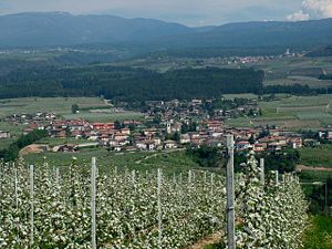
Taio
| Taio | |||
|---|---|---|---|

|
|||
| Panorama of Taio | |||
| Country | Italy | ||
| region | Trentino-South Tyrol | ||
| province | Trento (TN) | ||
| local community | Predaia | ||
| Coordinates | 46 ° 19 ' N , 11 ° 4' E | ||
| height | 515 m slm | ||
| surface | 11.31 km² | ||
| Residents | 3,032 (2013) | ||
| Population density | 268 inhabitants / km² | ||
| patron | Saint Vigilius | ||
| Church day | June 26th | ||
| Telephone code | 0463 | CAP | 38012 |
Taio ( Nones : Taj ; German outdated: Thayl or Theyl ) is a fraction of the municipality ( comune ) Predaia and until 2015 was an independent municipality in the province of Trento in the Trentino-Alto Adige region . Taio is the capital and parish of Predaia.
geography
Taio is located about 28.5 kilometers north-northwest of Trento in the Non Valley on the Noce River at an altitude of 551 mslm. The place name may derive from the Italian taglio , which can be translated as "clearing". The municipality belonging fractions Dardine, Dermulo, Mollaro, Segno, Torra and Tuenetto. Neighboring communities were Coredo , Denno , Nanno , Sanzeno , Tassullo , Tres , Ton and Vervò .
history
Effective January 1, 2015, Taio was merged with Coredo , Smarano , Tres and Vervò to form the new municipality of Predaia .
traffic
The Strada Statale 43 della Val di Non leads through Taio from San Michele all'Adige to the Santa Giustina dam . Taio station is served by trains on the Ferrovia Trento – Malè (Trento-Marilleva line).
Sons and daughters
- Eusebius Franz Kühn (1645–1711), Jesuit missionary, cartographer