Taiping Dao (island)
| Taiping Dao | ||
|---|---|---|
| ISS photo | ||
| Waters | Pacific Ocean | |
| Archipelago | Spratly Islands | |
| Geographical location | 10 ° 22 '37 " N , 114 ° 22' 0" E | |
|
|
||
| length | 1.36 km | |
| width | 350 m | |
| surface | 46 ha | |
| Highest elevation | 3.8 m | |
| Residents | 150 (1999) 326 inhabitants / km² |
|
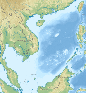
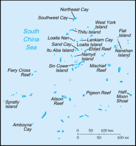
| Map of the Spratly Islands, in the middle Taiping Dao ( Itu Aba Island ) | ||
Taiping Dao ( Chinese 太平 島 , Pinyin Tàipíng Dǎo or Itu Aba ; Filipino : Ligaw / Ligao ; Vietnamese : Đảo Ba Bình ) is the largest natural island of the Spratly Islands in the South China Sea with an area of 46 hectares . However, the man-made island on Fiery Cross Reef exceeds it by five times. The island has an elliptical shape 1.4 km long and a maximum of 350 m wide. It is the main island of the Tizard Bank , a larger atoll of the Spratly Islands.
The island is administered by the Republic of China ; however, the Philippines , Vietnam and the People's Republic of China also lay claim to territory on the island.
Naming
The different ownership claims are also expressed in different names. The island is called Ba Bình in Vietnamese or Ligaw in Filipino ("the lost" or "the wild"). Chinese fishermen have always given it two names: Huángshānmǎ Jiāo ( 黃山 馬 礁 ) or Huángshānmǎ Zhì ( 黃山 馬 峙 ).
When the island was occupied by the Japanese from 1939 to 1945, it was given the name 長島 . In English it is usually referred to as Itu Aba , derived from the Malay- spoken question “What is that?”. An interpretation is also possible that says that the island was named after two Vietnamese girls, Tu and Ba. This notation can be found on maps of the French colonial government of the Indochina period. The Chinese name Taiping comes from a warship that was the first to call at the island after the Japanese surrender .
history
The island was officially claimed by France as part of Indochina in 1887 and occupied by French troops in 1930 . During the Second World War it was conquered by Japan and expanded into a submarine base. Administratively, the island was added to the Takao ( Kaohsiung ) district, part of the then Japanese colony of Taiwan .
After the Japanese withdrew, Taiping Dao came under the control of the Republic of China in 1946 . Associated with this was incorporation into Guangdong Province .
The Republic of China (Taiwan) secured its claim to the island against Japan in the 1952 Treaty of Taipei .
The Republic of China has around 150 coastguards stationed on the island (as of 1999). In addition, there is no permanent population.
Despite the opposition on the part of Vietnam, a runway for aircraft was built on the island in 2005 . This makes it possible to land the C-130 Hercules transporter , among other things .
The island is a major point of contention between neighboring Taiwan , People's Republic of China , Vietnam and the Philippines . There are historical, geostrategic and economic reasons for this. Especially after it became known that large oil reserves are to be stored under the Spratly Islands , demands are increasing on Taiping Dao, the largest island with the best infrastructure .
administration
The Republic of China administers the island as part of the Qijin District , which is part of the southern Taiwanese port city of Kaohsiung . The People's Republic of China claims the island as part of the prefecture-level city of Sansha in Hainan Province .
See also
Web links
- Images and detailed information to the island (Engl.)
- Geographical and military information at www.globalsecurity.org (engl.)
Remarks
- ↑ 長島 "Long Island", probably Nagashima or Nagajima read, but also can Osashima / jima or Choto read


