
Tamsa (Uttar Pradesh)
|
Tamsa Tons |
||
|
|
||
| Data | ||
| location | Uttar Pradesh ( India ) | |
| River system | Ganges | |
| Drain over | Chhoti Sarju → Ganges → Bay of Bengal | |
| source | west of Faizabad | |
| muzzle | at Mau in the Chhoti Sarju coordinates: 25 ° 57 '2 " N , 83 ° 33' 51" E 25 ° 57 '2 " N , 83 ° 33' 51" E
|
|
| Chhoti Sarju | ||
| origin | Junction from the Ghaghara | |
| muzzle | southwest of Ballia in the Ganges 25 ° 43 ′ 56 ″ N , 84 ° 8 ′ 25 ″ E
|
|
The Tamsa ( Hindi : तमसा Tamsā [ ˈtʌmsɑː ]), Tons or Chhoti Sarju is a left tributary of the Ganges in the northern Indian state of Uttar Pradesh . It is not to be confused with the Tamsa (Tons) in Madhya Pradesh or the River Tons in Uttarakhand .
The Tamsa rises west of Faizabad as Marha Nadi and flows parallel to the Ghaghara towards the southeast. It passes the cities of Akbarpur and Azamgarh . At Mau the river changes its name again and flows as Chhoti Sarju to the confluence with the Ganges southwest of Ballia . The river runs through Faizabad , Ambedkar Nagar , Azamgarh , Mau and Ballia districts .
Web links
Maps of the course of the river:
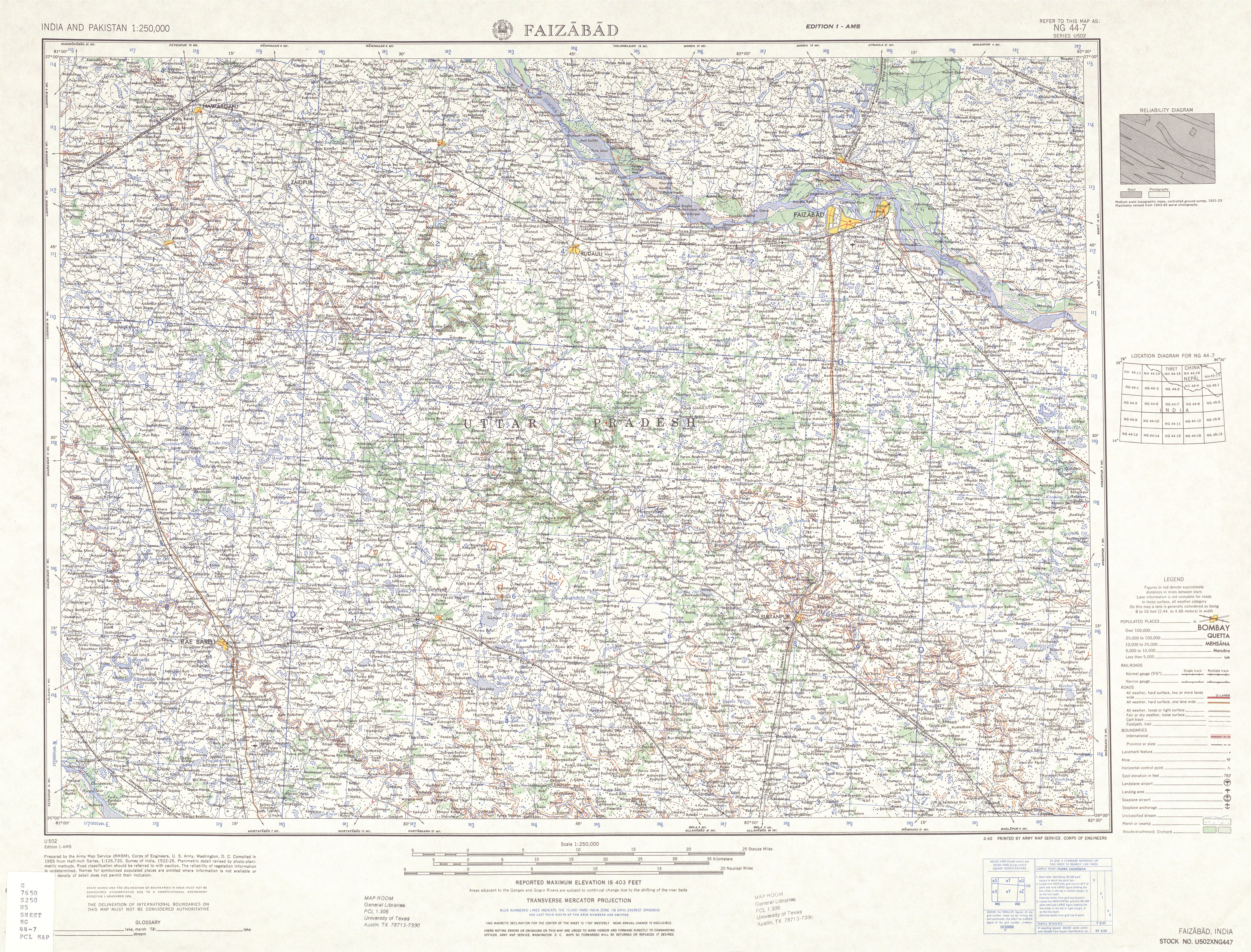
- TK250 sheet NG44-7 FAIZABAD - upper course as Marha Nadi , name change: from Karmpur further as Tons River (Tamsa) to the west of Akbapur.
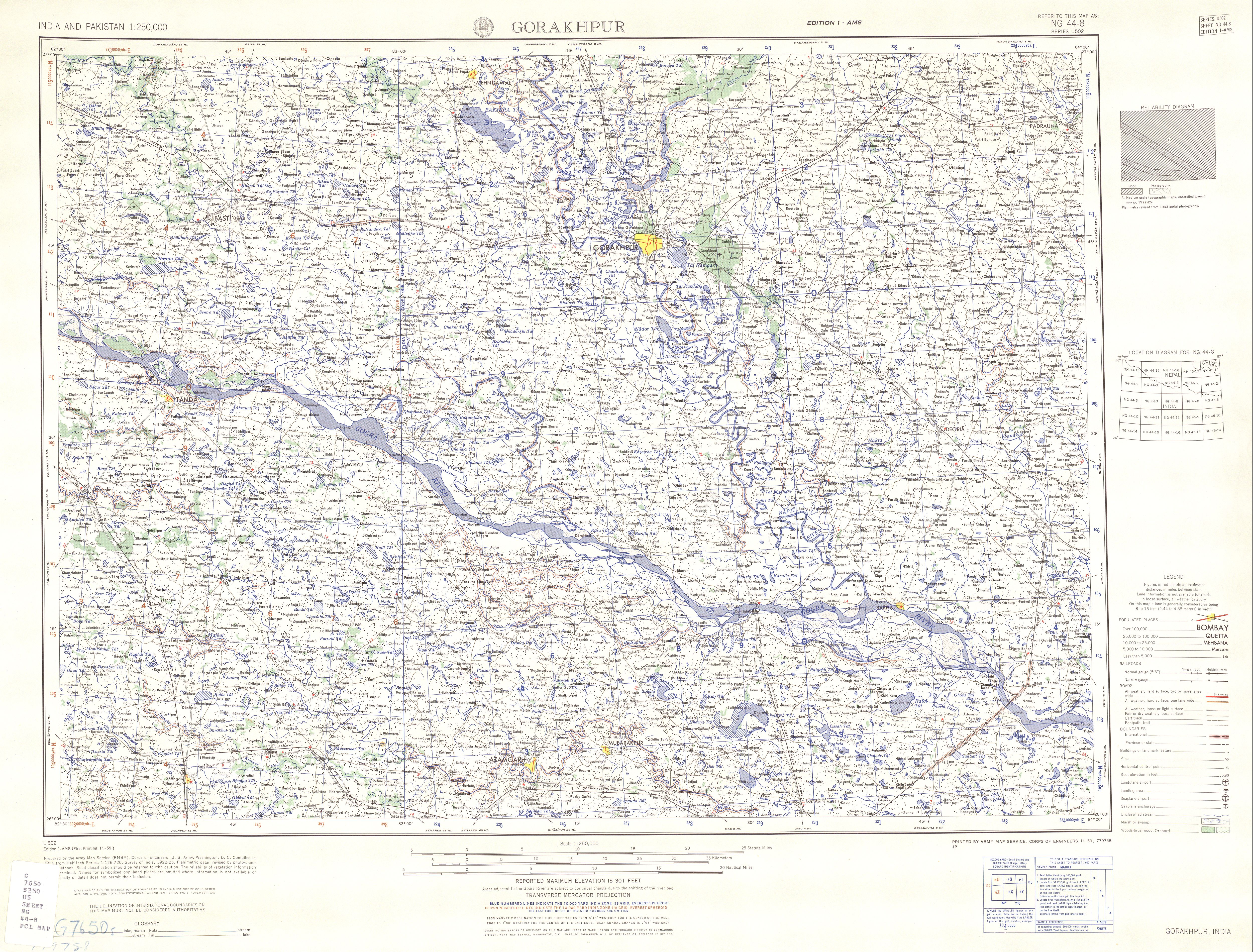
- TK250 sheet NG44-8 GORAKHPUR - middle course as Tons River (Tamsa), section from Akbapur to northwest of the city of Mau
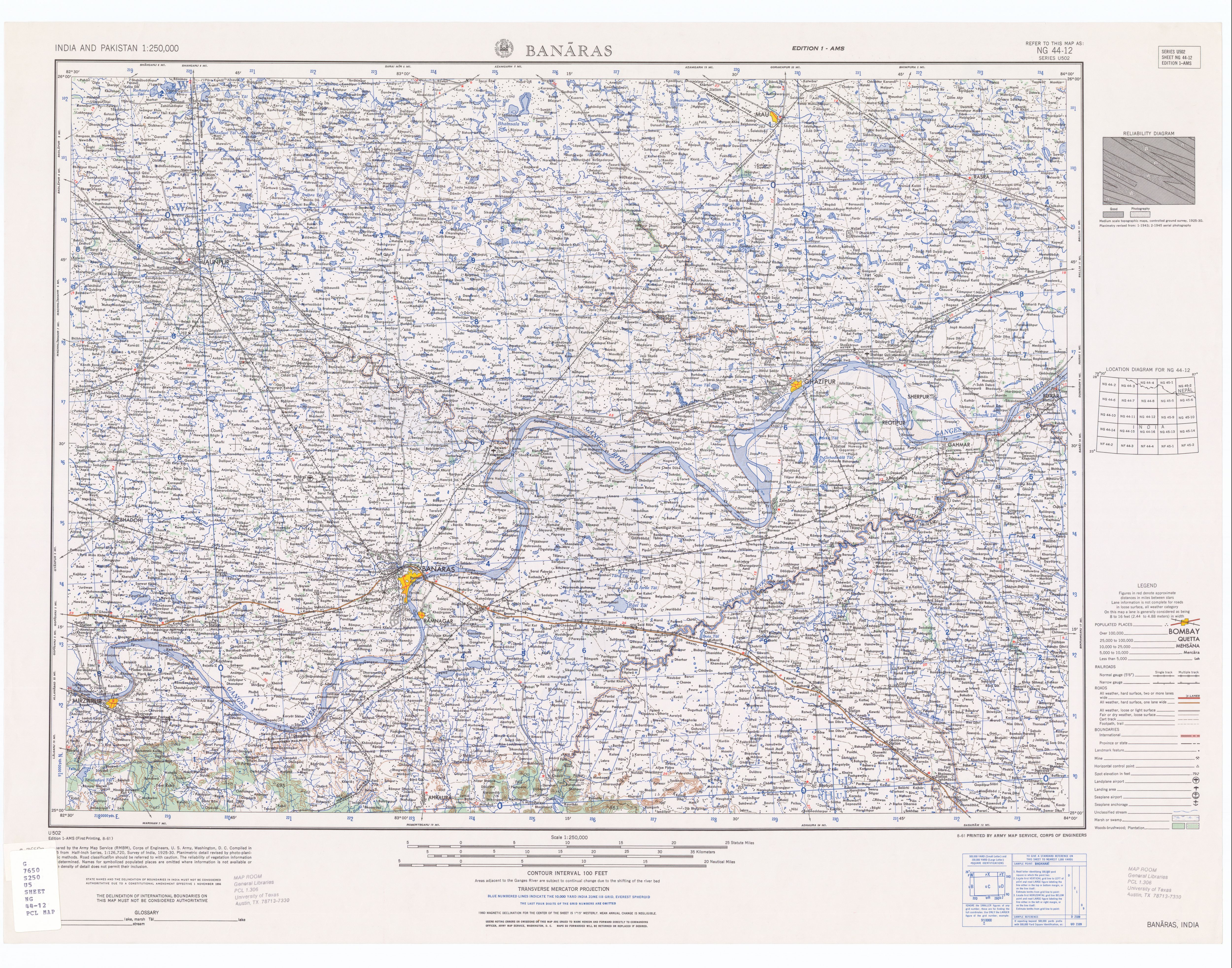
- TK250 sheet NG44-12a BANARAS middle course as Tons River (Tamsa), name change: from Mau Chhoti Sarju
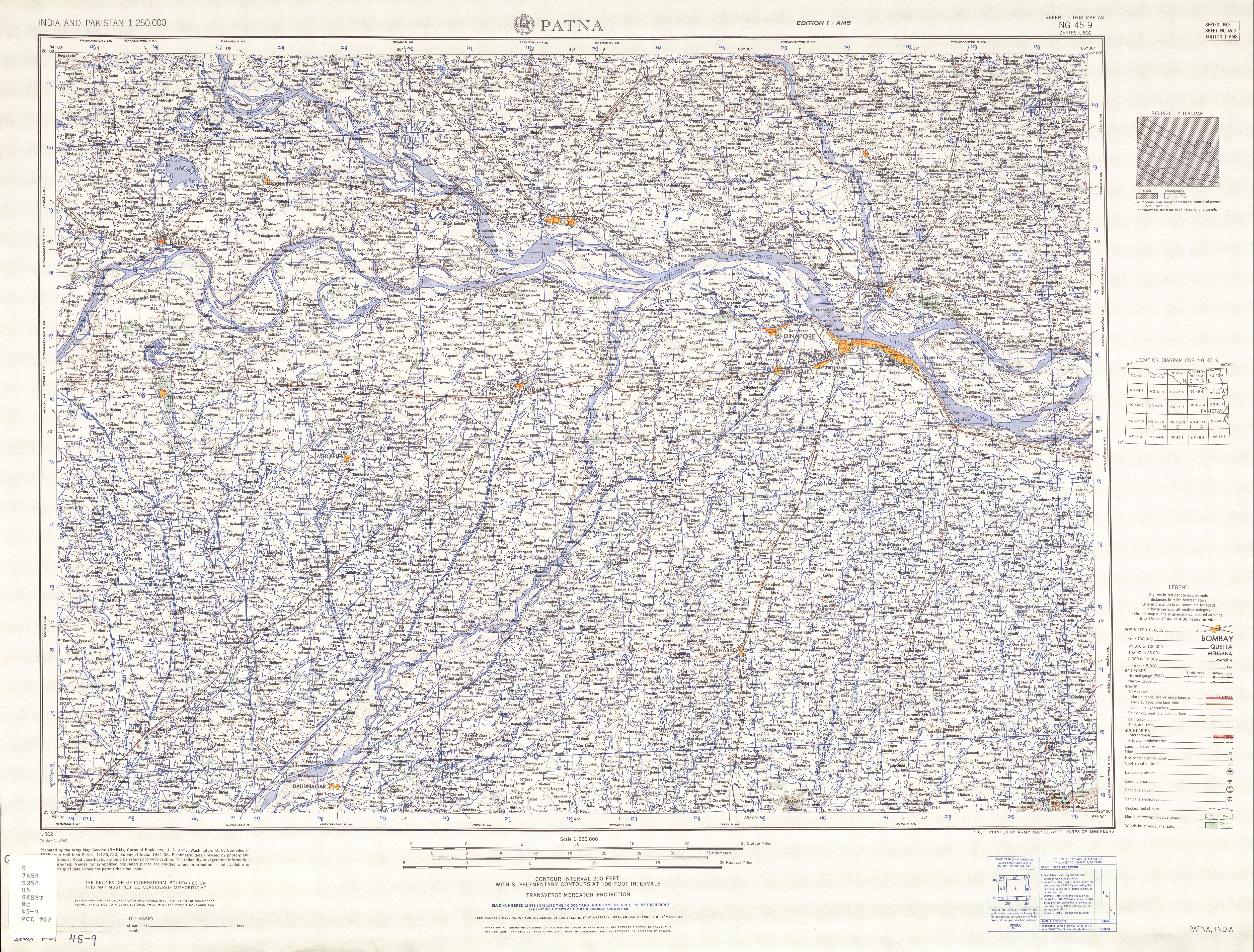
- TK250 sheet NG44-9 PATNA - lower reaches of the Chhoti Sarju with mouth area in the Ganges (near Balli)