Tesluhiw
| Tesluhiw | ||
| Теслугів | ||

|
|
|
| Basic data | ||
|---|---|---|
| Oblast : | Rivne Oblast | |
| Rajon : | Radyvyliv district | |
| Height : | 227 m | |
| Area : | 1.936 km² | |
| Residents : | 1,051 (2001) | |
| Population density : | 543 inhabitants per km² | |
| Postcodes : | 35512 | |
| Area code : | +380 3633 | |
| Geographic location : | 50 ° 19 ′ N , 25 ° 18 ′ E | |
| KOATUU : | 5625888501 | |
| Administrative structure : | 3 villages | |
| Mayor : | Bohdan Schablij | |
| Address: | вул. Шевченка 56 35 512 с. Теслугів |
|
| Statistical information | ||
|
|
||
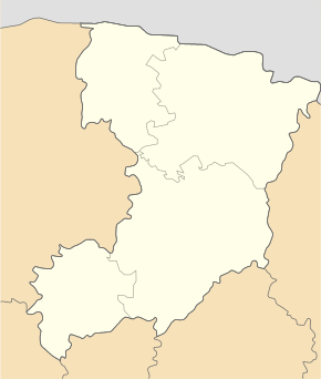
Tesluhiw (Ukrainian Теслугів ; Russian Теслугов / Teslugow , Polish Tesłuhów ) is a village in the Ukraine in the Rivne Oblast , it is located south of the river Pljaschiwka about 20 kilometers north of the Raion capital Radywyliwne and 72 kilometers southwest of the Oblast capital Rivne .
The village forms together with the villages Korytne (Коритне) and Pljaschiwka (Пляшівка) the district council of Tesluhiw.
The village was mentioned in writing for the first time in 1545 and was in the aristocratic republic of Poland-Lithuania , Ruthenian Voivodeship , until the Third Partition of Poland in 1795 . Then it came to the Russian Empire and was incorporated into the Volhynian governorate . After the end of the First World War , the borders were redrawn, the place came to the Second Polish Republic and from 1934 was incorporated into the Gmina Tesłuhów , Powiat Dubno , Volyn Voivodeship . During the Second World War , the place came to the Soviet Union in September 1939 and was incorporated into the Ukrainian SSR , after the beginning of the German-Soviet War , the place came under German rule in the Reichskommissariat Ukraine , general district Volhynien-Podolia , district Dubno , but was after at the end of the Second World War re-affiliated to the Ukrainian SSR. Tesluhiw has been part of today's Ukraine since 1991.
In 1940 the place briefly became the capital of the Rajons of Tesluhiw Rajon , but this was moved to Kosyn in the same year .
Web links
- Tesłuhów . In: Filip Sulimierski, Władysław Walewski (eds.): Słownik geograficzny Królestwa Polskiego i innych krajów słowiańskich . tape 12 : Szlurpkiszki – Warłynka . Walewskiego, Warsaw 1892, p. 318 (Polish, edu.pl ).

