Testa del Leone
| Testa del Leone | ||
|---|---|---|
|
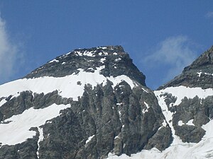
Testa del Leone from the southeast, on the right the Colle del Leone |
||
| height | 3715 m above sea level M. | |
| location | Border province of Aosta , Italy / Canton of Valais , Switzerland | |
| Mountains | Valais Alps | |
| Dominance | 0.26 km → Pic Tyndall | |
| Notch height | 135 m ↓ Colle del Leone | |
| Coordinates , ( CH ) | 45 ° 58 '15 " N , 7 ° 38' 34" O ( 615 817 / 91064 ) | |
|
|
||
| First ascent | 1857 from the Valtournanche | |
The Testa del Leone ( Italian ; in French : Tête du Lion , both means 'lion's head') is 3715 m above sea level. M. high mountain in the border ridge between Switzerland and Italy between Matterhorn ( 4478 m above sea level. M. ) and Dent d'Hérens ( 4,171 m above sea level. M. ). The ridge is part of the main Alpine ridge and forms the watershed between the Rhone and Po .
Location and surroundings
The Testa del Leone is located 1¼ kilometers southwest of the Matterhorn and is separated from it by the Colle del Leone ( 3580 m above sea level ). The southwest ridge of the Matterhorn, also known as the Lion Ridge , begins at the Colle del Leone . The course of the border ridge turns west at the Testa del Leone, three kilometers to the west rises the Dent d'Hérens in this ridge , which is separated from the Testa del Leone by the Colle Tournanche ( 3473 m above sea level ).
On the south side of the Testa del Leone there are two smaller glaciers , to the southwest of the Ghiacciaio del Leone and southeast of the Ghiacciaio Superiore del Cervino . To the north, the Tiefmatten Glacier , a source glacier of the Zmutt Glacier , reaches close to the Testa del Leone.
Ascent
The starting point for an ascent is usually the Rifugio degli Abruzzi on the south side of the mountain. The Testa del Leone is often crossed from the Italian side when climbing the Matterhorn to get to the Rifugio Carrel . The first known ascent took place in 1857 starting from Breuil-Cervinia in Valtournanche .
literature
- Michael Waeber: Valais Alps. Area guides for hikers, mountaineers, ski tourers, climbers. 13th edition, Bergverlag Rudolf Rother, Munich 2003, ISBN 3-7633-2416-X
Web links
- Testa del Leone on the ETHorama platform
- Map section Testa del Leone at map.geo.admin.ch
- Col de Lion on the ETHorama platform
Individual evidence
- ^ A b Charles Knapp, Maurice Borel, Victor Attinger, Heinrich Brunner, Société neuchâteloise de geographie (editor): Geographical Lexicon of Switzerland . Volume 3: Krailigen - Plentsch . Verlag Gebrüder Attinger, Neuenburg 1905, p. 153, keyword Testa del Leone ( scan of the lexicon page ).
- ^ M. Waeber: Valais Alps. Marginal number 1342, see literature

