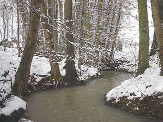
Thalbach (Ill)
| Thalbach | ||
|
The Thalbach near Knœringue |
||
| Data | ||
| Water code | FR : A10-0200 | |
| location |
France
|
|
| River system | Rhine | |
| Drain over | Ill → Rhine → North Sea | |
| source | in the municipality of Folgensbourg 47 ° 32 ′ 38 ″ N , 7 ° 25 ′ 45 ″ E |
|
| Source height | 460 m | |
| muzzle | in the municipality of Altkirch in the Ill coordinates: 47 ° 37 '54 " N , 7 ° 15' 57" E 47 ° 37 '54 " N , 7 ° 15' 57" E |
|
| Mouth height | 270 m | |
| Height difference | 190 m | |
| Bottom slope | 9.1 ‰ | |
| length | 20.9 km | |
| Catchment area | 78.4 km² | |
| Drain at the mouth |
MQ |
536 l / s |
| Left tributaries | Hundsbach | |
| Right tributaries | Walbach | |
The Thalbach is a river in France that runs in the Haut-Rhin department in the Grand Est region . It is a right tributary of the Ill .
geography
course
The Thalbach rises in the municipality of Folgensbourg , generally drains in a north-westerly direction through the Sundgau landscape and flows into the Ill after almost 21 kilometers in the municipality of Altkirch .
Tributaries
- Erlenbaechle ( right )
- Isbach ( right ), 2.5 km
- Hundsbach ( left ), 4.9 km
- Krummengraben ( left )
- Wahlbach ( right ), 8.8 km
- Krebsbaechle ( left ), 1.5 miles
Places on the river
Hydrology
At the confluence of the Thalbach in the Ill , the mean flow rate (MQ) is 0.54 m³ / s; the catchment area here covers 78.4 km².
At the Wittersdorf gauge , the average annual runoff of the Thalbach was calculated over a period of 31 years (1980–2010) . The catchment area at this point, at 70 km², corresponds to around 89.3% of the entire catchment area of the river.
The flow rate fluctuates quite strongly over the course of the year. The highest water levels are measured between December and May. The flow rate reached its peak in December at 0.96 m³ / s. From June onwards the discharge drops sharply and reaches its lowest level in August with 0.18 m³ / s, after which it increases again from month to month.
The monthly mean discharge (MQ) of the Thalbach in m³ / s, measured at the Wittersdorf hydrological station.
Data calculated from the values from 1980–2010

Remarks
- ↑ Is listed at SANDRE under rivière l'ill
- ↑ a b see web link: Débits caractéristiques de le Thalbach
- ↑ At SANDRE Walbach
- ↑ Banque Hydro - A1072010 Le Thalbach à Wittersdorf (menu item: Synthèse)
Web links
- Débits caractéristiques de le Thalbach (French; PDF; 12 kB)
