
Tiszakóród
| Tiszakóród | |||||
|
|||||
| Basic data | |||||
|---|---|---|---|---|---|
| State : | Hungary | ||||
| Region : | Northern Great Plain | ||||
| County : | Szabolcs-Szatmár-Bereg | ||||
| Small area until December 31, 2012 : | Fehérgyarmat | ||||
| District since 1.1.2013 : | Fehérgyarmat | ||||
| Coordinates : | 48 ° 6 ' N , 22 ° 43' E | ||||
| Area : | 16.69 km² | ||||
| Residents : | 702 (Jan. 1, 2011) | ||||
| Population density : | 42 inhabitants per km² | ||||
| Telephone code : | (+36) 44 | ||||
| Postal code : | 4946 | ||||
| KSH kódja: | 08794 | ||||
| Structure and administration (as of 2019) | |||||
| Community type : | local community | ||||
| Structure : | Tiszakóród, Újkóródtanya | ||||
| Mayor : | Péter Kósa (independent) | ||||
| Postal address : | Kossuth Lajos u. 23 4946 Tiszakóród |
||||
| Website : | |||||
| (Source: A Magyar Köztársaság helységnévkönyve 2011. január 1st at Központi statisztikai hivatal ) | |||||


Tiszakóród is a Hungarian community in the district Fehérgyarmat in Szabolcs-Szatmár-Bereg County . The southern district of Újkóródtanya belongs to the municipality .
Geographical location
Tiszakóród is about 20 kilometers northeast of the town of Fehérgyarmat on the Tisza , which forms the border with Ukraine . Hungarian neighboring communities are Tiszacsécse and Túristvándi . North of the border is the Ukrainian town of Wary .
Attractions
- Reformed church, originally built in the 15th century, rebuilt in the Baroque style in the 18th century, the tower was added in 1893
- World War I Memorial ( I. világháborús emlékmű ), created in 1926 by the sculptor János Csiszér
traffic
Road No. 4129 runs through Tiszakóród. The nearest Hungarian train station is in the southwest of Penyige , the nearest Ukrainian train station in the east is in Wylok .
photos

Tiszakóród Reformed Church
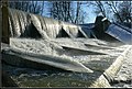
Barrage at the door

.jpg)
Web links
- Official website ( Hungarian )
- Tisza-Kóród in A Pallas nagy lexikona (Hungarian)
- Tiszakóród bei Szatmár Tour (Hungarian)
- Tiszakóród (Hungarian)