Tuxer Joch
| Tuxer Joch | |||
|---|---|---|---|
|
Tuxer Joch from Weitental towards the south |
|||
| Compass direction | west | east | |
| Pass height | 2338 m above sea level A. | ||
| State / State |
|
||
| Watershed | Kaserer Bach , Schmirnbach , Sill , Inn | Tuxbach , Zemmbach , Ziller , Inn | |
| Valley locations | St. Jodok am Brenner | Hintertux , Mayrhofen | |
| expansion | trail | ||
| Mountains | Tuxer (N) / Zillertaler (S) Alps | ||
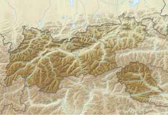
| Map (Tyrol) | |||
|
|
|||
| Coordinates | 47 ° 5 '42 " N , 11 ° 38' 38" E | ||
The Tuxer Joch is a mountain pass on the border between the Tux Alps in the north and the Zillertal Alps in the south. The yoke is at an altitude of 2338 m above sea level. A. and connects the Zillertal with the Wipptal a little north of the Brenner Pass . The Tuxerjochhaus is located northeast below the top of the pass .
history
A mule track, which was often used in the past, leads over the Tuxer Joch from the Brenner to the Zillertal. The yoke was already known to prehistoric people, finds of devices made of chert and southern Alpine flint bear witness to an inspection of the Tuxer Joch by Stone Age people . A decorative pin from the Middle Bronze Age was found on the pass. Herds of cattle moved across the yoke, as did farmers and small traders with local products. Sometimes, however, funeral procession passed over the yoke, because since the village of Tux once belonged to the community of Schmirn on the other side of the yoke, the dead also had to be moved there. This canonical division was later changed, but the secular administration was not changed until 1926. In the meantime, the Tux valley had long been oriented towards the Zillertal , with which it was connected by a road. The Tuxer Joch lost its importance for local traffic in the 19th century and has only served as a crossing point for hikers since then.
In 1940/41 a plan was drawn up to build a tourist road over the Tuxer Joch, and even a complete project was worked out. This project was not used solely for tourist purposes, because a side street to the Brenner Pass was of considerable strategic military importance for the German armed forces .
Literature and map
- Steffan Bruns: Alpine passes - The passes on both sides of the Brenner Route 1 . L.-Staackmann-Verlag, Munich 2010, ISBN 978-3-88675-256-0
- Alpine Club Map 1: 50,000, sheet 33, Tux Alps
Individual evidence
- ^ Steffan Bruns: Alpine passes. The passes on both sides of the Brenner route . tape 1 . L. Staackmann Verlag, Munich 2010, ISBN 978-3-88675-256-0 , p. 46 .

