Oberstein (Arenshausen)
|
Oberstein
Community Arenshausen
Coordinates: 51 ° 21 ′ 26 " N , 9 ° 58 ′ 54" E
|
||
|---|---|---|
| Height : | 245 m above sea level NN | |
| Postal code : | 37318 | |
| Area code : | 036081 | |
|
Location of Oberstein in Thuringia |
||
|
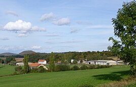
View of the place
|
||
Oberstein is a hamlet-like district of Arenshausen in the Eichsfeld district in Thuringia and emerged from the two former manor complexes Oberstein and Unterstein .
geography
Oberstein lies together with the buildings of Unterstein in a spacious valley basin of the Steinsbach , a small tributary of the Leine on the left , about two kilometers south of Arenshausen and 10 kilometers west of Heilbad Heiligenstadt . Due to the local situation, the state road 2009 leads to Gerbershausen . The valley edges are mostly forested on the slopes and hills ( Hennefeste : 446 m in the east, Mühlenberg : 342 m in the south, Heuberg : 369 m in the west).
history
The medieval town of Steina was mentioned in documents in 1318 and 1371. The town probably extended along the entire Steinsbach. There is no clear geographical demarcation from the neighboring settlements of Friedrichshausen and Rendehausen, which fell desolate in the 14th century. The Teichmühle, Mittelmühle and Saumühle probably already belonged to the place. In 1376 the village was damaged by Hermann von Hessen. At the end of the 15th century the place was mentioned as desolate .
Land and goods were owned by various lords, such as the Archbishop of Mainz, the Landgrave of Hesse, the nobles of Kerstlingerode, Plesse and other lords. Over the centuries, some of these properties passed into the possession of the von Hanstein family . After the Lords of Hanstein gave up Hanstein Castle , they also came to Steina and built two manors here , the Unterstein in 1544 and the Oberstein in 1564 . Gut Unterstein was built by Jost von Hanstein and his wife Anna and consisted of a large mansion on half-timbered houses, farm buildings and the Mittelmühle with around 330 hectares of land and used to belong administratively to Gerbershausen. Gut Oberstein consisted of an older and a younger manor house, as well as farm buildings and 117 hectares of usable space. A carved double coat of arms on the stair tower of the older manor house with the year 1582 indicates the builder.
The post-war history begins with the land reform in the hamlet. Both properties were expropriated and converted into a state-owned seed and animal breeding company. In the course of time, the traditional mansions and some other buildings were demolished, the last in 1989. The animal breeding farm was assigned to the state-owned Steinheuterode estate and the dairy cattle facility began to be built according to East German standards. The dairy cattle facility was converted into a GmbH after reunification .
The Teichmühle (Oberstein) and the Mittelmühle (Unterstein) still exist, but the Teichmühle has been left to decay. To the east, in a small forest, is the former cemetery of the goods with old graves.
literature
- Levin von Wintzingeroda-Knorr : The desert areas of the Eichsfeld: Directory of the desert areas, prehistoric ramparts, mines, courts of justice and waiting areas within the districts of Duderstadt, Heiligenstadt, Mühlhausen and Worbis. Göttingen (O. Hendel) 1903, pages 911-914
- Walter Rassow: Descriptive representation of the older architectural and art monuments of the district of Heiligenstadt. Reprint Eichsfelddruck Heiligenstadt 1990, pp. 328–332
Web links
Individual evidence
- ↑ Dr. Erhard Müller: The place names of the district of Heiligenstadt. Heilbad Heiligenstadt 1989, page 43
- ^ Wolfgang Kahl : First mention of Thuringian towns and villages. A manual. Rockstuhl Verlag, Bad Langensalza, 2010, ISBN 978-3-86777-202-0 , p. 210
- ↑ Levin von Wintzingeroda-Knorr : Die Wüstungen des Eichsfeldes: Directory of the desert areas, prehistoric ramparts, mines, courts of law and waiting areas within the districts of Duderstadt, Heiligenstadt, Mühlhausen and Worbis. O. Hendel, Göttingen 1903, p. 911 ff.
- ↑ Volker Große, Gunter Römer: Lost cultural sites in Eichsfeld 1945 to 1989 A documentation . Eichsfeld Verlag, Heilbad Heiligenstadt, 2006, pp. 90–94.

