Völkershausen (Wanfried)
|
Völkershausen
City of Wanfried
Coordinates: 51 ° 9 ′ 44 ″ N , 10 ° 9 ′ 38 ″ E
|
|
|---|---|
| Height : | 171 (169-183) m above sea level NHN |
| Area : | 8.7 km² |
| Residents : | 279 (Dec. 31, 2013) |
| Population density : | 32 inhabitants / km² |
| Incorporation : | 1st October 1971 |
| Postal code : | 37281 |
| Area code : | 05655 |
The village of Völkershausen is the smallest district of Wanfried in the Werra-Meißner district in Hesse .
Geographical location
Völkershausen is about three kilometers south of Wanfried an der Werra . The Schlierbachswald extends to the west of the village, the Schlierbach , which gives it its name, flows through Völkershausen and flows into the Werra on the eastern edge of the village.
Gut Marienhof , a former Vorwerk of the manor Völkershausen, is also part of the local area .
history
The place was first mentioned in a document in 876. The village has been part of the city of Wanfried since October 1, 1971.
In 1978 Völkerhausen became state winner and one year later national winner in the competition Our village should be more beautiful .
Attractions
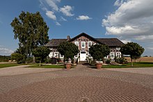
- Manor on the banks of the Werra
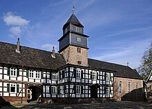
- Evangelical village church (patronage church) on the manor
- Gut Marienhof
- Former forest office
- Feudal house
- Half-timbered houses
Infrastructure
In the village there is a community center , a children's playground and a sports field .
Personalities
- Georg Philipp Eduard Huschke (born June 26, 1801 in Hann. Münden , † February 8, 1886 in Breslau ), lawyer, grew up on the manor Völkershausen
literature
- Jochen Ebert, Ingrid Rogmann, Peter Wiedersich and Heide Wunder (eds.): Schwebda - an aristocratic village in the 17th and 18th centuries . With a contribution to the rule and village of Völkershausen (Hessian research on historical regional and folklore 46), Kassel 2006
Individual evidence
- ^ Völkershausen, Werra-Meißner district. Historical local dictionary for Hessen. (As of January 25, 2016). In: Landesgeschichtliches Informationssystem Hessen (LAGIS).
- ↑ Geodata Center: Völkershausen , accessed in February 2016.
- ^ Federal Statistical Office (ed.): Historical municipality directory for the Federal Republic of Germany. Name, border and key number changes in municipalities, counties and administrative districts from May 27, 1970 to December 31, 1982 . W. Kohlhammer GmbH, Stuttgart / Mainz 1983, ISBN 3-17-003263-1 , p. 388 .
Web links
- Völkershausen on the city of Wanfried's website
- Völkershausen, Werra-Meißner district. Historical local dictionary for Hessen. In: Landesgeschichtliches Informationssystem Hessen (LAGIS).
- Literature about Völkershausen in the Hessian Bibliography


