Val Trompia
| Val Trompia | ||
|---|---|---|
|
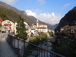
Val Trompia at Tavernole sul Mella |
||
| location | Brescia Province , Lombardy , Italy | |
| Waters | Mella | |
| Mountains | Adamello Presanella Alps , Lake Garda mountains | |
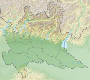
| Geographical location | 45 ° 42 ′ N , 10 ° 11 ′ E | |
|
|
||
| length | 50 km | |
The Val Trompia is a valley in northern Italy that runs from the Passo del Maniva to the Po Valley near Brescia . It has a length of 50 km and the Mella flows through it. The Val Trompia is one of the three main valleys of the province of Brescia , the other two are the Valcamonica and the Val Sabbia .
The valley shows no traces of landscape formation by glaciers . It has veins in the higher valley regions, which indicate a lively mining activity since ancient times. The iron weapon production that has existed since that time gave the valley inhabitants extensive autonomy and reduced taxation during the Venetian rule.
The name of the valley is derived from the Celtic tribe of the Trumpiliners , whose name is mentioned on the Tropaeum Alpium , built in today's La Turbie to glorify the Augustan Alpine campaigns , among the defeated Alpine peoples.
Municipalities in Val Trompia
Amalgamated in the Comunità montana della valle Trompia
- Bovegno
- Concesio
- Collebeato
- Gardone Val Trompia
- Lodrino
- Marcheno
- Marmentino
- Sarezzo
- Tavernole sul Mella
- Villa Carcina
Web links
- Valle Trompia old mining area , accessed November 11, 2013

