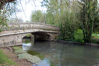
Vanne (river)
| Vanne | ||
|
The Vanne at Bagneaux |
||
| Data | ||
| Water code | FR : F35-0400 | |
| location | France , Grand Est and Bourgogne-Franche-Comté regions | |
| River system | His | |
| Drain over | Yonne → Seine → English Channel | |
| source | in the municipality of Fontvannes 48 ° 16 ′ 43 ″ N , 3 ° 52 ′ 24 ″ E |
|
| Source height | approx. 145 m | |
| muzzle | at Sens in the Yonne coordinates: 48 ° 11 '26 " N , 3 ° 16' 8" E 48 ° 11 '26 " N , 3 ° 16' 8" E |
|
| Mouth height | approx. 65 m | |
| Height difference | approx. 80 m | |
| Bottom slope | approx. 1.4 ‰ | |
| length | 59 km | |
| Catchment area | 990 km² | |
| Medium-sized cities | Sens | |
The Vanne is a river in France that runs through the Grand Est and Bourgogne-Franche-Comté regions. It rises in the local area of Fontvannes , generally drains west to south-west on the northern border of the landscape of the Pays d'Othe and flows into the Yonne after 59 kilometers on the southern outskirts of Sens as a right tributary . On its way, the Vanne crosses the Aube and Yonne departments .
Places on the river
- Fontvannes
- Estissac
- Villemaur-sur-Vanne
- Villeneuve-l'Archevêque
- Theil-sur-Vanne
- Malay-le-Grand
- Maillot
- Sens
Water supply to Paris
In the 1870s, numerous springs in the catchment area of the Vanne were taken in order to improve the drinking water supply of Paris and diverted 157 kilometers to Paris in the so-called Aqueduc de la Vanne . Numerous engineering structures of this aqueduct can be seen along the river. The most striking is the crossing of the Yonne between Sens and Pont-sur-Yonne (see picture). The aqueduct joins in the forest of Fontainebleau , west of Moiret-sur-Loing , with the two other aqueduc du Loing et du Lunain and the Aqueduc de la Voulzie . All three together represent the drinking water supply from Paris to the south.
