Velička (Bečva)
| Velička | ||
|
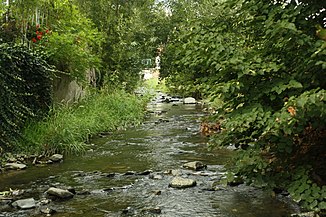
The Velička near Lhotka |
||
| Data | ||
| location | Olomoucký kraj ( Czech Republic ) | |
| River system | Danube | |
| Drain over | Bečva → March → Danube → Black Sea | |
| source | near the desert Heřmánky in the Oder Mountains 49 ° 39 ′ 19 ″ N , 17 ° 36 ′ 20 ″ E |
|
| Source height | 565 m nm | |
| muzzle | in Hranice in the Bečva Coordinates: 49 ° 32 '46 " N , 17 ° 43' 48" E 49 ° 32 '46 " N , 17 ° 43' 48" E |
|
| Mouth height | 245 m nm | |
| Height difference | 320 m | |
| Bottom slope | 18 ‰ | |
| length | 17.5 km | |
| Catchment area | 66.1 km² | |
| Drain |
MQ |
510 l / s |
| Small towns | Potštát , Hranice | |
The Velička ( German Welicka ) is a right tributary of the Bečva in the Czech Republic .
geography
The Velička rises one kilometer north of the Heřmánky desert at the western foot of the Ziegenhalsberg ( 583 m ) in the Oder Mountains at the Libavá military training area and is also known as Heřmánecký potok on its upper reaches . On its way to the south-east, the stream leaves the military area after three kilometers, feeds the Harta reservoir and flows between Potštát and Padesát Lánů . Below Michalovka , the Velička forms a deep forested valley in which the Potštátské Skalní město natural monument and the remains of the Puchart Castle are located.
Boňkov, Podlesný Mlýn and Lhota follow on the further course. The Velička then leaves the Oder Mountains and flows into the plains. The river is initially bridged by the D 1 motorway and via Velká it reaches Hranice , where it flows around the city center to the west. In Hranice the Velička joins the Bečva after 17.5 kilometers together with the Ludina . Its catchment area is 66.1 km².
Tributaries
- Boškovský potok (r), below the Harta pond
- Kovářovský potok (l), Potštát
- Koutecký potok (l), at the Puchart castle ruins
- Bradelný potok (r), near Boňkov
- Mraznice (l), above Velká
