Malschwitz administration community
| coat of arms | Germany map | |
|---|---|---|
 Help on coat of arms |
Coordinates: 51 ° 14 ' N , 14 ° 31' E |
|
| Basic data (as of 2013) | ||
| Existing period: | 1996-2013 | |
| State : | Saxony | |
| County : | Bautzen | |
| Area : | 93.21 km 2 | |
| Residents: | 5110 (Dec. 31, 2010) | |
| Population density : | 55 inhabitants per km 2 | |
| Association structure: | 2 municipalities | |
| Association administration address : |
Dorfplatz 26 02694 Malschwitz |
|
| Website : | ||
| Administrative Chairman: | Matthias Seidel | |
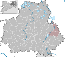
The Malschwitz administrative community was an administrative community in the Free State of Saxony in the Bautzen district . It was located in the northeast of the district, about 12 km northwest of the district town of Bautzen . The Spree ran through the community area . The federal motorway 4 ran through the south of the community area . This can be reached via the Bautzen-Ost connection .
The administrative association was closed on September 24, 1996. On January 1, 2013, the community of Guttau was incorporated into the community of Malschwitz and the administrative community thus dissolved.
Member municipalities
Two communities belonged to the Malschwitz administrative community:
- Malschwitz with the districts Malschwitz ( Malešecy ), Pließkowitz ( Plusnikecy ), Briesing ( Brězynka ), Niedergurig ( Delnja Hórka ), Doberschütz ( Dobrošecy ), Kleinbautzen ( Budyšink ), Preititz ( Přiwćicy ), Cannewitz ( Skanecy ), Rackel ( Skanecy ) Baruth ( Bart ), Brießnitz ( Brězecy ), Dubrauke ( Dubrawka ), Buchwalde ( Bukojna ) and Gleina ( Hlina ).
- Guttau with the districts Brösa ( Brězyna ) Guttau ( Hućina ) Halbendorf / Spree ( Połpica ) Kleinsaubernitz ( Zubornička ) Lieske ( Lěskej ) Lömischau ( Lemišow ) Neudorf / Spree ( Nova Wjes / Sprjewja ) Ruhenthal ( Wotpočink ) and Wartha ( Stróža )

