
Administrative community Rietschen
| coat of arms | Germany map | |
|---|---|---|
 Help on coat of arms |
Coordinates: 51 ° 24 ' N , 14 ° 47' E |
|
| Basic data | ||
| Existing period: | 2000– | |
| State : | Saxony | |
| Headquarters: | Dresden | |
| County : | Goerlitz | |
| Area : | 104.84 km 2 | |
| Residents: | 3385 (Dec. 31, 2019) | |
| Population density : | 32 inhabitants per km 2 | |
| License plate : | GR, LÖB, NOL, NY, WSW, ZI | |
| Association key : | 14 6 26 5233 | |
| Association structure: | 2 municipalities | |
| Association administration address : |
Forsthausweg 2 02956 Rietschen |
|
| Website : | ||
| Association chairman: | Ralf Brehmer | |
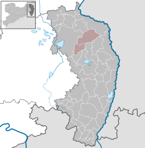
| Location of the administrative community Rietschen in the district of Görlitz | ||
  |
||

The administrative community Rietschen , Upper Sorbian Zarjadniski zwjazk Rěčicy , is a Saxon administrative community in the district of Görlitz . It is located in the north of the district, about 14 km north of the district town of Niesky . The White Schöps flows through the administrative area . The landscape is characterized in the north by the ongoing mining of lignite and the recultivation areas that are created after the mining, and in the south by an extensive pond and forest landscape. The federal road 115 and the Berlin – Görlitz railway line run through the administrative area.
Communities
The administrative community became after the dissolution of the administrative association Heidedörfer on January 1st, 2000 by the municipalities
- Rietschen (Rěčicy) with the municipality parts Rietschen, Altliebel (Stary Lubolń) , Daubitz (Dubc) , Hammerstadt (Hamoršć) , Neuliebel (Nowy Lubolń) and Teicha (Hatk)
- Kreba-Neudorf (Chrjebja-Nowa Wjes) with the municipality parts Kreba (Chrjebja) , Lache (Čorna Truha) , Neudorf (Nowa Wjes) and Tschernske (Černsk)
founded.