
Administrative community Olbersdorf
| coat of arms | Germany map | |
|---|---|---|
 Help on coat of arms |
Coordinates: 50 ° 52 ' N , 14 ° 46' E |
|
| Basic data | ||
| State : | Saxony | |
| Administrative region : | Dresden | |
| County : | Goerlitz | |
| Area : | 60.47 km 2 | |
| Residents: | 9655 (Dec. 31, 2019) | |
| Population density : | 160 inhabitants per km 2 | |
| License plate : | GR, LÖB, NOL, NY, WSW, ZI | |
| Association key : | 14 6 26 5 227 | |
| Association structure: | 4 municipalities | |
| Association administration address : |
Oberer Viebig 2a 02785 Olbersdorf |
|
| Website : | ||
| Administrative Chairman: | Andreas Foerster | |
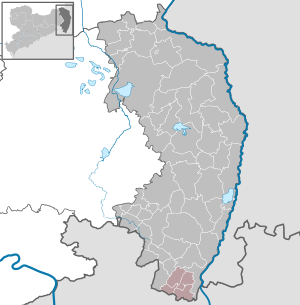
| Location of the administrative community Olbersdorf in the district of Görlitz | ||
  |
||

The administrative community Olbersdorf is a Saxon administrative community in the district of Görlitz . It is located in the south of the district, about 5 km south of the city of Zittau . The community area includes the entire Zittau Mountains except for the Großschönau district of Waltersdorf . In the south the administrative community borders on the Czech Republic and in the north on the city of Zittau.
The municipalities of Olbersdorf, Bertsdorf-Hörnitz, Kurort Oybin and the municipality of Kurort Jonsdorf have formed this administrative community since 2000. Around half of the approximately 11,000 inhabitants live in Olbersdorf, the seat of the administrative association.
The municipalities with their districts
- Bertsdorf-Hörnitz with the districts of Bertsdorf and Hörnitz
- Jonsdorf
- Olbersdorf
- Oybin with the districts Oybin, Hain , Lückendorf and Niederoybin