
Administrative association Diehsa
| coat of arms | Germany map | |
|---|---|---|

|
Coordinates: 51 ° 13 ' N , 14 ° 47' E |
|
| Basic data | ||
| Existing period: | 1994– | |
| State : | Saxony | |
| County : | Goerlitz | |
| Area : | 164.99 km 2 | |
| Residents: | 6451 (Dec. 31, 2019) | |
| Population density : | 39 inhabitants per km 2 | |
| License plate : | GR, LÖB, NOL, NY, WSW, ZI | |
| Association key : | 14 6 26 5 502 | |
| Association structure: | 4 municipalities | |
| Association administration address : |
Kollmer Strasse 1 02906 Waldhufen |
|
| Website : | ||
| Association chairman: | Dirk Beck | |
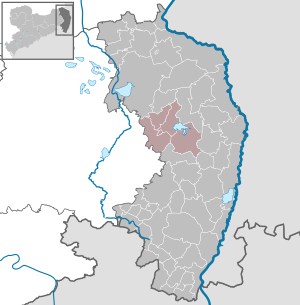
| Location of the Diehsa administrative association in the Görlitz district | ||
  |
||

The Diehsa Administrative Association is a Saxon administrative association in the Görlitz district . It was founded on December 15, 1994 and is based in the Gewandhaus built in 1841 in the Diehsa district of Waldhufen .

The Diehsa administrative association is located in the central part of the district, about 10 km south of Niesky and 10 km west of the district town of Görlitz . The association is located between the Königshain Mountains in the south and the forest and pond-rich Upper Lusatian heath and pond landscape in the north. The landscape is mainly characterized by rolling hills. The federal highway 115 runs north and the federal highway 6 south of the association. The federal motorway 4 runs through the administrative area and can be reached via the Nieder Seifersdorf connection . The area borders the villages of Jänkendorf and Diehsa on the Quitzdorf dam , which dams the river Schwarzer Schöps . In the west, the association area borders on the wooded Hohe Dubrau .
Member municipalities
The four communities belong to the association
- Hohendubrau with the districts Dauban , Gebelzig , Groß Radisch , Groß Saubernitz , Jerchwitz , Ober Prauske , Sandförstgen , Thräna , Weigersdorf
- Mücka with the districts of Mücka, Förstgen , Förstgen-Ost and Leipgen
- Quitzdorf am See with the districts Horscha , Kollm , Petershain , Sproitz , Steinölsa
- Waldhufen with the districts of Diehsa , Jänkendorf , Nieder Seifersdorf and Thiemendorf