Dauban
|
Dauban
Dubo Hohendubrau municipality
Coordinates: 51 ° 17 ′ 0 ″ N , 14 ° 37 ′ 40 ″ E
|
|
|---|---|
| Residents : | 267 (Jun 30, 2014) |
| Incorporation : | April 1, 1938 |
| Incorporated into: | Weigersdorf |
| Postal code : | 02906 |
| Area code : | 035932 |
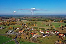
Dauban , Upper Sorbian , is the northernmost part of the Saxon community Hohendubrau in the district of Görlitz . The place is located in the Sorbian settlement area of Upper Lusatia .
geography
Dauban is in the form of a street village-like estate in the northwest of the municipality near the district boundary. Surrounding villages are Zimpel and Tauer in the north, Förstgen in the northeast, Förstgen-Ost and Leipgen in the east, Weigersdorf in the southeast and in the district of Bautzen Kleinsaubernitz in the southwest, Wartha in the west and Halbendorf / Spree as well as Neudorf / Spree in the northwest.
The Hohe Dubrau , which gave the municipality its name, is located in a south-easterly direction. The Dauban Forest, which is part of a larger forest area in the Upper Lusatian Heath and Pond Landscape Biosphere Reserve, extends north of the village .
The soil contains parabrown earth and pseudogley from loess / sand loess.
history
There were several archaeological finds in the district that prove a prehistoric settlement. Among other things, these are a Neolithic single find and Bronze Age settlement and grave remains. After the Great Migration , this area was uninhabited for several centuries. The first documentary mention is to be found in 1377 as Duban in the Bautzener Dingbuch (1359-1399).
When the rulership of Baruth was divided between the seven sons of Christoph von Gersdorff , Dauban came to Georg von Gersdorff in 1527 in the Buchwald region . Joachim von Gersdorff sold Dauban in 1610 to the Bautzen council. After more than 20 further changes of ownership, the estate came to the Counts of Lippe-Weißenfeld in 1808, a branch of the ruling House of Lippe , which owned the Baruth (Upper Lusatia) rulership and to which it, with Dauban, belonged until 1945.
The Kingdom of Saxony had to cede many parts of the country to Prussia in 1815 because it fought on the French side in the Napoleonic Wars . Among other things , Lower Lusatia, which had belonged to Saxony since the Peace of Prague , and the north-eastern part of Upper Lusatia came to Prussia. As a result, Dauban was assigned to the newly founded district of Rothenburg ( province of Silesia ) in 1816 and re- parish in 1830 from Baruth, still in Saxony, to Förstgen .
The estate administration had a steam sawmill built around 1890. After several modernizations it could be operated until 2000 when it was destroyed by a fire.
On April 1, 1938 Dauban was incorporated into Weigersdorf.
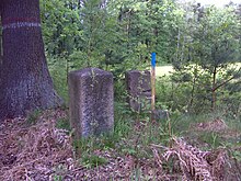
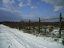
Fighting in the last days of the Second World War and the around 200 hectare tank firing range established by the NVA in 1963 favored the development of a very varied herb and shrub layer in the Dauban Forest, with some very rare and endangered plants. The firing range was abandoned in 1991 and its ground was cleared of ammunition by 1996. In order to prevent reforestation and lignification caused by dominant shrubs in at least part of the area, a 155 hectare enclosure was fenced in in 2002, in which elk from Poland were released. In 2013 there were 14 moose in the gate - this high was not reached afterwards. Many moose died in the years that followed. In 2016, the remaining 3 animals were relocated to a smaller gate and efforts were made to accommodate the animals in a large enclosure in Denmark. In 2017 the experiment with the moose was given up and the gate demolished again.
On July 1, 1995 the communities Weigersdorf, Gebelzig and Groß Radisch merged to form the community Hohendubrau , whereby Dauban became a district of this.
Population development
| year | Residents |
|---|---|
| 1825 | 203 |
| 1863 | 263 |
| 1871 | 318 |
| 1885 | 265 |
| 1905 | 282 |
| 1910 | 294 |
| 1919 | 270 |
| 1925 | 250 |
| 1999 | 321 |
| 2002 | 308 |
| 2008 | 296 |
| 2009 | 285 |
In 1777 there were 3 possessed men , 5 gardeners and 17 cottagers in Dauban .
Between 1825 and 1871, the population grew from around 200 inhabitants to almost 320 inhabitants, after which a slow decline to 250 inhabitants in 1925 became apparent. Due to the early incorporation, further population figures are not transmitted. In 1999, 321 people were registered with their main residence in Dauban, compared to 296 in June 2008.
Dauban originally had a predominantly Sorbian population . In 1863 there were 223 Sorbs among the 263 inhabitants, according to official information, in 1884 Arnošt Muka had even counted 262 Sorbs out of 285 inhabitants for his Sorbian statistics in Upper Lusatia. This corresponds to a Sorbian population of 84.8% (1863) and 91.9% (1884). Today, Sorbian has disappeared from everyday life as a colloquial language in Dauban.
Place name
The place name developed over Duban (1377), Tupan (around 1400), Daubin (1490), Dauben (1658), Tauben (1732) and Tauban (1768) to today's Dauban (1831). The Sorbian form of the name is proven in 1719 as Dabon and Dubow , it developed via Duby (1800) and Dubow (1835) to today's Dubo (1835 and 1843). The name is derived, similar to Daubitz ( Dubc ), from the Sorbian dub "oak". The Upper Sorbian name is derived from the plural duby (see also Viereichen , Štyri Duby ) and from the genitive dubow .
Sources and further reading
literature
- Upper Lusatian heather and pond landscape. A regional survey in the area of Lohsa, Klitten, Großdubrau and Baruth (= values of the German homeland . Volume 67 ). Böhlau Verlag, Cologne 2005, ISBN 3-412-08903-6 , p. 279-284 .
- From the Muskauer Heide to the Rotstein. Home book of the Lower Silesian Upper Lusatia District . Lusatia Verlag , Bautzen 2006, ISBN 3-929091-96-8 , p. 283 .
- Robert Pohl : Heimatbuch des Kreis Rothenburg O.-L. for school and home . Buchdruckerei Emil Hampel, Weißwasser O.-L. 1924, p. 243 .
Footnotes
- ^ Dauban in the Digital Historical Directory of Saxony
- ↑ a b From Muskauer Heide to Rotstein , p. 283.
- ↑ Municipal directory Germany 1900. Retrieved on August 1, 2013 (sum of the population of the rural municipality and the Dauban manor district).
- ^ Ernst Tschernik: The development of the Sorbian rural population (= German Academy of Sciences in Berlin - publications of the Institute for Slavic Studies . Volume 4 ). Akademie-Verlag, Berlin 1954, p. 116 .
- ↑ Ernst Eichler , Hans Walther : Oberlausitz toponymy - studies on the toponymy of the districts of Bautzen, Bischofswerda, Görlitz, Hoyerswerda, Kamenz, Löbau, Niesky, Senftenberg, Weißwasser and Zittau. I name book (= German-Slavic research on naming and settlement history . Volume 28 ). Akademie-Verlag, Berlin 1975, p. 48 .


