Jerchwitz
|
Jerchwitz
Hohendubrau municipality
Coordinates: 51 ° 14 ′ 0 ″ N , 14 ° 41 ′ 30 ″ E
|
|
|---|---|
| Height : | 240 m above sea level NN |
| Area : | 2.13 km² |
| Residents : | 51 (Jun 30, 2014) |
| Population density : | 24 inhabitants / km² |
| Incorporation : | July 1, 1995 |
| Postal code : | 02906 |
| Area code : | 035876 |
Jerchwitz ( Upper Sorbian ) is a district of the Saxon community of Hohendubrau in the district of Görlitz . With around 50 inhabitants, Jerchwitz is the smallest district in the municipality.
geography
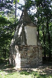
Jerchwitz is located between the Hohendubrau districts Groß Radisch and Gebelzig near the Hohen Dubrau , the elevation that gave the municipality of Hohendubrau its name. The Monumentberg rises northeast of the village . There is an observation tower on top of it with a view of the surrounding villages and the Quitzdorf dam .
The place is for the most part surrounded by forests and some ponds; the inaccessible pond areas in the direction of Gebelzig, which offered refuge in times of war, have been drained and turned into agricultural land.
history
Local history
Jerchwitz was first mentioned as Erichstorf in 1373 in the second oldest Görlitz council book, which was kept from 1342 to 1400. The place is parish in Gebelzig and Jerchwitz was also secularly connected with Gebelzig until the middle of the 17th century. From 1658 to 1664 Hans Heinrich von Gersdorf was the owner of Jerchwitz, which also owned Groß Radisch and Sandförstgen .
The Jerchwitz manor is documented for the year 1667, but in the 18th century it was only a preliminary work of the Ober Gebelzig manor.
In 1928 Jerchwitz was incorporated into Thräna , and only ten years later, Thränas was incorporated into Groß Radisch.
Population development
| year | Residents |
|---|---|
| 1825 | 61 |
| 1863 | 52 |
| 1871 | 87 |
| 1885 | 84 |
| 1905 | 64 |
| 1925 | 50 |
| 1999 | 68 |
| 2002 | 64 |
| 2006 | 51 |
In the Gebelziger church book in 1671, in addition to the manor, six inns in Jerchwitz were named, which a century later were divided into five gardeners and one housekeeper .
Since the first Prussian population census, which took every inhabitant into account, the numbers of Jerchwitz have moved within a relatively small range of 50 to 90 inhabitants. When Arnošt Muka compiled statistics on the Sorbs of Upper Lusatia in the 1880s , he counted 42 Sorbs and 34 Germans in Jerchwitz. With a Sorbian population of 55%, Jerchwitz was clearly behind the other Hohendubrau districts in these statistics. By the middle of the 20th century, the language change to German in town was largely complete.
Place name
Based on the name Erichstorf mentioned in 1373, the modifications Erisdorf, Ergisdorf, Erichsdorf, Erichsdorff, Erychstorff and Erisdorf can be found in the early 15th century . In the first half of the 16th century the name has already changed more; in 1533 Gyrgisdorff, Erdorff and the reference upf wendisch Gercho can be identified. In the further course of the 16th century the German name came closer to the Sorbian one, so that Girchitz in 1546 and Giergesdorf in 1563 were mentioned. With Jecherwitz in 1569, the name already resembles today's spelling, later variants are Jürgwitz (1732), Jergwitz (1758) and finally Jerchwitz (1768).
After Ernst Eichler , Jerchwitz is named after an Erich, but the Sorbian form of the name, which got the G prosthesis in German, has prevailed.
Today's Upper Sorbian name Jerchecy has a similar development behind it, although it is only mentioned later and rarely in documents. From Gercho (1533) developed Jerkezy (1800), Jyrchezy (1835) and Jerchecy (1843). Later the name variants Jeŕchecy, Jěŕchecy and Jěŕchicy can be found . In 1924 Pohl gave Jarczowice as a Sorbian name.
Culture and sights
- Festival of Lights (Saturday before the 3rd Advent)
- Thräna game reserve
Sources and further reading
literature
- From the Muskauer Heide to the Rotstein. Home book of the Lower Silesian Upper Lusatia District. Lusatia Verlag, Bautzen 2006, ISBN 3-929091-96-8 , p. 281 .
Footnotes
- ^ Jerchwitz in the Digital Historical Directory of Saxony
- ↑ Von der Muskauer Heide zum Rotstein , p. 281.
- ^ Ernst Tschernik: The development of the Sorbian population (= German Academy of Sciences in Berlin - publications of the Institute for Slavonic Studies . Volume 4 ). Akademie-Verlag, Berlin 1954, p. 116 ff .
- ↑ Ernst Eichler , Hans Walther : Oberlausitz toponymy - studies on the toponymy of the districts of Bautzen, Bischofswerda, Görlitz, Hoyerswerda, Kamenz, Löbau, Niesky, Senftenberg, Weißwasser and Zittau. I name book (= German-Slavic research on naming and settlement history . Volume 28 ). Akademie-Verlag, Berlin 1975, p. 112 .
- ^ Robert Pohl : Heimatbuch des Kreis Rothenburg O.-L. for school and home . Buchdruckerei Emil Hampel, Weißwasser O.-L. 1924, p. 247 .
