
Administrative community Theres
| coat of arms | Germany map | |
|---|---|---|

|
Coordinates: 50 ° 1 ′ N , 10 ° 26 ′ E |
|
| Basic data | ||
| Existing period: | 1978– | |
| State : | Bavaria | |
| Administrative region : | Lower Franconia | |
| County : | Hatred Mountains | |
| Area : | 57.73 km 2 | |
| Residents: | 5936 (Dec. 31, 2019) | |
| Population density : | 103 inhabitants per km 2 | |
| License plate : | HAS, EBN, GEO , HOH | |
| Association key : | 09 6 74 5613 | |
| Association structure: | 3 municipalities | |
| Association administration address : |
Rathausstrasse 3 97531 Theres |
|
| Website : | ||
| Chairman of the administrative association : | Hans-Peter Reis | |
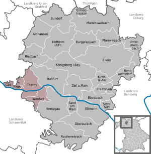
| Location of the administrative community Theres in the Haßberge district | ||
  |
||

In the administrative community Theres in the Lower Franconian district of Haßberge , the following communities have come together to handle their administrative business:
- Gädheim , 1242 inhabitants, 9.58 km²
- Theres , 2705 inhabitants, 30.78 km²
- Wonfurt , 1989 inhabitants, 17.37 km²
The administrative community is based in Theres.
Individual evidence
- ↑ "Data 2" sheet, Statistical Report A1200C 202041 Population of the municipalities, districts and administrative districts 1st quarter 2020 (population based on the 2011 census) ( help ).