Vliet (South Holland)
| Vliet | |
|---|---|
|
Leidschendam lock |
|
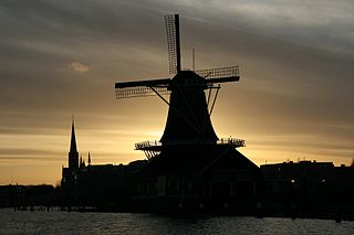
| Silhouette of the "De Salamander" mill |
The Vliet is a by hydraulic artificially dug water canal in the Dutch province of South Holland and part of the Rhine-Schie Canal . The Vliet runs from Leiden , where the Trekvliet empties, via Voorschoten and Leidschendam-Voorburg as Delftse Vliet via Rijswijk to Delft and empties into the Schie . The Schie flows into the Meuse in Schiedam near Rotterdam .
history
In the Middle Ages , the Vliet was a connection between the Oude Rijn (the Dutch Old Rhine) and the Schie . Presumably, today's Vliet was dug towards the end of the twelfth or beginning of the 13th century . Shortly afterwards a canal was dug from the Vliet from Voorburg to The Hague . This Trekvliet was completed in 1345. The Waterschappen Rijnland and Delfland had a different water level . In the course of Leidschendam-Voorburg there is a lock that used to be between Veur and Stompwijk . Instead of the lock in Leidschendam there was until the mid- 17th century, a ship coating , which is why the passengers to and from the Vliet track boat had to change to their journey continue. Heavy goods had to be handled according to stacking law , which resulted in taxes being levied.
Kilometer posts
In 1893, cast iron kilometer stones with basalt stone hectometer blocks were erected along the Vliet. Of the original 24 kilometer posts, 10 have remained.
predecessor
The Fossa Corbulonis Canal was only partially the same as the Vliet and was already completely silted up when the Vliet was dug. Fossa Corbulonis was a waterway dug by the Roman Legion in AD 47 on behalf of Gnaeus Domitius Corbulo and a connection between the Oude Rijn near Matilo (Leiden-Roomburg Fort), on the eastern edge of Leiden and the Gantel , a presumed flood of the Meuse, who ran from Rijswijk to Naaldwijk . That was the northern Limes of the Roman Empire with fortifications along the Oude Rijn, connected from the Castellum Matilo to the Meuse, where a naval base was assumed to be near Naaldwijk. The canal made it possible to avoid the much more dangerous sea route.
Individual evidence
- ↑ Kilometers along the Vliet , overzicht according to Google My Maps by Jeroen Struyk


