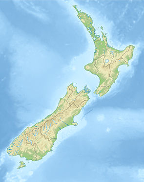
Wairepo Kettleholes Conservation Area
| Wairepo Kettleholes Conservation Area | ||
| Geographical location | ||
|
|
||
| Coordinates | 44 ° 22 ′ S , 169 ° 53 ′ E | |
| Country : | New Zealand | |
| Region (s) : | Canterbury | |
| Location: | south of Lake Ohau and north-northwest of the village of Omarama | |
| Protected area | ||
| Protected area type: | Conservation Area | |
| Founded: | 2005 | |
| Precursor: | Glen Eyrie Downs Station | |
| expansion | ||
| Number of areas: | 1 | |
| Length : | 3.0 km | |
| Width : | Max. 1.8 km | |
| Area : | approx. 4.2 km² | |
| The Office Department of Conservation | ||
| Office: |
Te Manahuna / Twizel Office 15 Wairepo Road Twizel 7901 |
|
The Wairepo Kettleholes Conservation Area is a protected area in the Canterbury region of the South Island of New Zealand . The area is under the Department of Conservation .
geography
The area of the Wairepo Kettleholes Conservation Area is located around 8 km south of Lake Ohau and around 14 km north-northwest of the village of Omarama in a wide plain that extends west and north-west of the Diadem Range . The protected area measures around 3 km in a south-east-north-west extension and a maximum of 1.8 km in a south-west-north-east direction. It covers an area of approximately 4.2 km². The area is located at a height of around 600 m above sea level.
Kettle holes
In the English language, kettle holes are recesses in the landscape that can form in the landscape when glaciers retreat. They are mostly filled with water, like small lakes.
In the area of the Wairepo Kettleholes Conservation Area , three of these water-filled hollows can be found. Other recesses are only temporarily filled with water or have even dried out. The Ohau Glacier that formed this landscape covered the land more than 10,000 years ago.
Flora and fauna
The area of the Conservation Area is overgrown with red tussock grass and reed-like grass. Pine trees that spread across the landscape are from time to time removed from the landscape by members of nature conservation organizations.
Birds, we the black stilt ( black stilt ), the wrybill ( wrybill ), the black-fronted tern ( black-fronted tern ) and Shoveler ( shoveller duck ) are frequent in the area.
literature
- Day walks in Mackenzie / Waitaki . Wairepo Kettleholes. Department of Conservation,p. 16,accessed May 5, 2020.
Web links
- Wairepo Kettleholes Conservation Area . Department of Conservation,accessed May 5, 2020.
- Wairepo Kettleholes Track . Department of Conservation,accessed May 5, 2020.
Individual evidence
- ↑ a b Topo maps . Land Information New Zealand , accessed May 5, 2020 .
- ↑ Coordinates and longitudes were determined using Goggle Earth Pro Version 7.3.2.5776 on May 5, 2020
- ↑ Wairepo Kettle Holes . In: NZ Topo Map . Gavin Harriss , accessed May 5, 2020 .
- ↑ a b c Wilding pines cleared . In: ed = Otago Daily Times . Allied Press Limited , December 10, 2011, accessed May 5, 2020 .
- ↑ Wairepo Kettle Holes Conservation Area . Department of Conservation , accessed May 5, 2020 .
