St James Conservation Area
| St James Conservation Area | ||
| Geographical location | ||
|
|
||
| Coordinates | 42 ° 20 ′ S , 172 ° 37 ′ E | |
| Country : | New Zealand | |
| Region (s) : | Canterbury | |
| Location: | northwest of Hanmer Springs and south of Nelson Lakes National Park | |
| Protected area | ||
| Protected area type: | Conservation Area | |
| Founded: | 2008 | |
| Precursor: | private farmland known as St James Station | |
| expansion | ||
| Number of areas: | 1 | |
| Length : | approx. 37 km | |
| Width : | Max. 32 km | |
| Area : | 780 km² | |
| Mountains : | St James Range | |
| Lakes : | Lake Tennyson , Lake Guyon | |
| Rivers : | Waiau River , Clarence River , Stanley River , Edwards River | |
| The Office Department of Conservation | ||
| Office: |
Rangiora Office 32 River Road Rangiora 7400 |
|
The St James Conservation Area is a nature reserve in the Canterbury region of the South Island of New Zealand . The area is under the Department of Conservation .
geography
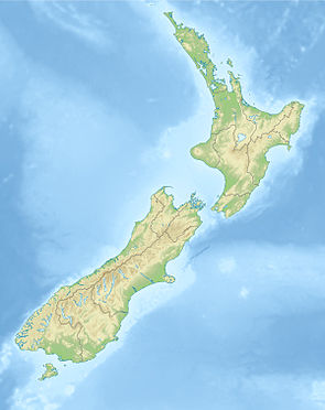
The 78,000 hectare large St James Conservation Area is located south of the Nelson Lakes National Park , bounded between the Lake Sumner Forest Park in the west, the Molle Worth Recreation Reserve in the east and the Hanmer Forest Park in the south. Kaikoura is 75 km to the east and the next larger town is Hanmer Springs around 8 km southeast. The St James Range , in which the nature reserve is located, has its highest point in the 2126 m high Mount Princess in the north. The rivers Waiau River , Clarence River , Stanley River , Edwards River flow through the St James Conservation Area and in the northern part of the nature reserve are the lakes Lake Tennyson , Lake Guyon and the small lake Princess Bath .
history
The St James Conservation Area was known as St James Station and, at 78,000 hectares, was the largest privately owned farm in the country prior to its purchase by the New Zealand Government's Nature Heritage Fund in 2008 . The area has since been owned by the find and administered by the Department of Conservation .
literature
- New Zealand Touring Atlas . 5th edition. Hema Maps , Brisbane 2015, ISBN 978-1-877302-92-3 (English).
Web links
- St James Conservation Area . Department of Conservation,accessed February 15, 2020.
- St James Conservation Area . (PDF; 4.5 MB)Department of Conservation, June 2014,accessed on February 15, 2020.
Individual evidence
- ^ St James Conservation Area . 2014, p. 2 , accessed on February 15, 2020 (Flyer).
- ^ St James Conservation Area . 2014, p. 3 , accessed on February 15, 2020 (Flyer).
- ↑ Coordinates and longitudes were determined using Goggle Earth Pro Version 7.3.2.5776 on February 15, 2020
- ↑ St James Range . In: NZ Topo Map . Gavin Harriss , accessed February 15, 2020 .
- ^ St James Conservation Area: A Purchase for Ecosystem Service . (PDF; 7.1 MB) Landcare Research , p. 524 , accessed on February 16, 2020 .
