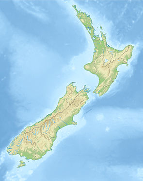
Hanmer Forest Park
| Hanmer Forest Park | ||
| Geographical location | ||
|
|
||
| Coordinates | 42 ° 28 ′ S , 172 ° 43 ′ E | |
| Country : | New Zealand | |
| Region (s) : | Canterbury | |
| Location: | around 75 km west of Kaikoura , near Hanmer Springs | |
| Protected area | ||
| Protected area type: | Forest Park | |
| Founded: | 1978 | |
| expansion | ||
| Number of areas: | 1 | |
| Length : | almost 28 km | |
| Width : | approx. 14 km | |
| Area : | approx. 130 km² | |
| Mountains : | western part of the Hanmer Range | |
| Rivers : | Edwards River, Grantham River, Rogerson River, Styx River | |
| The Office Department of Conservation | ||
| Office: |
Rangiora Office 32 River Road Rangiora 7400 |
|
The Hanmer Forest Park is a standing reserve forests in the region Canterbury on the South Island of New Zealand . The park is subordinate to the Department of Conservation .
geography
The Hanmer Forest Park is located around 75 km west of the coastal town of Kaikoura and north-west adjacent to the Hanmer Springs thermal baths, which are known in New Zealand . Adjacent to the south is the Hanmer Plain and to the north the Saint James Range extends . The park extends in a west-south-west-east-north-east direction over a length of almost 28 km and a maximum width of around 14 km. The highest point in the park is the Miromiro with a height of 1875 m .
The park can be reached from the south via New Zealand State Highway 7 and from the southeast via Hanmer Springs .
history
The planning of today's forest took place between 1900 and 1901. After tree nurseries had been set up in the Hanmer Plain , it was possible to start planting and planting the forest with exotic trees. The planting began in 1902 and carried out by prisoners from 1903 to 19013. The Radiata Pine and Douglas Fir plantings were intended for timber production, while other species were planted for test purposes to determine their economic viability.
In 1978 the forest was upgraded to Forest Park , but twelve years later the government sold the logging rights for 4800 hectares of forest to Carter Holt Harvey and in February 2000 the land to the Iwi of the Ngāi Tahu . Today the approximately 13,000 hectare park consists of native forests and a smaller part of foreign trees.
literature
- New Zealand Touring Atlas . 5th edition. Hema Maps , Brisbane 2015, ISBN 978-1-877302-92-3 (English).
Web links
- Hanmer Forest Park . Department of Conservation(English).
