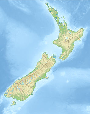
Kaweka Forest Park
| Kaweka Forest Park | ||
| Geographical location | ||
|
|
||
| Coordinates | 39 ° 16 ′ S , 176 ° 23 ′ E | |
| Country : | New Zealand | |
| Region (s) : | Hawke's Bay | |
| Location: | Northwest of Napier | |
| Protected area | ||
| Protected area type: | Forest Park | |
| Founded: | 1974 | |
| Precursor: | State Forest (1964) | |
| expansion | ||
| Number of areas: | 1 | |
| Length : | approx. 50 km | |
| Width : | Max. 25 km | |
| Area : | 590 km² | |
| Mountains : | Kaweka Range | |
| Rivers : | Ngarurora River , Mangatainoka River , Makino River , Donald River , Tutaekuri River | |
| The Office Department of Conservation | ||
| Office: |
Ahuriri / Napier Office 59 Marine Parade Napier 4110 |
|
| Photography from Forest Park | ||
 The Tits ( 1418 m ), south-southwest of the 1724 m high Kaweka |
||
 Mahaku Spur , east of the 1724 m high Kaweka |
||
The Kaweka Forest Park is a standing reserve forests in the region Hawke's Bay on the North Island of New Zealand . The park is subordinate to the Department of Conservation .
geography
The Kaweka Forest Park is located around 35 km northwest of Napier in the mountains of the Kaweka Range . The approximately 59,000 hectare park extends from the north, where it is adjacent to the Kaimanawa Forest Park , first in a south-south-east direction and then swings with its southern part to the south-south-west. The park has a length of approx. 50 km and measured approx. 25 km at its widest point. The highest point in the park is the Kaweka with a height of 1724 m .
The park can be reached via a country road coming from Hastings , which extends west to New Zealand State Highway 1 and runs through the southern part of Forest Park .
history
In 1964, the forest areas of the Kaweka Range were named a State Forest . This then resulted in the Kaweka Forest Park in 1974 with an area of 52,000 hectares , which at that time was still managed by the New Zealand Forest Service . Another 7,000 hectares were added later, so that the park, which came into the care of the Department of Conservation from 1987 , had a total area of 59,000 hectares.
literature
- New Zealand Touring Atlas . 5th edition. Hema Maps , Brisbane 2015, ISBN 978-1-877302-92-3 (English).
Web links
- Kaweka Forest Park . Department of Conservation,accessed March 3, 2020.
- Kaweka Forest Park & Puketitiri Reserves . (PDF; 761 kB)Department of Conservation, April 2005,accessed on March 3, 2020(English, flyer).
Individual evidence
- ^ New Zealand Touring Atlas . 2015, p. Map 19, Map 27, Map 28 .
- ↑ Coordinates and longitudes were determined using Goggle Earth Pro Version 7.3.2.5776 on March 3, 2020
- ^ New Zealand Touring Atlas . 2015, p. Map 28 .
- ↑ Kaweka Forest Park & Puketitiri Reserves . (PDF; 761 kB) Department of Conservation , April 2005, p. 7 f. , accessed on March 3, 2020 (English, flyer).
