Tararua Forest Park
| Tararua Forest Park | ||
| Geographical location | ||
|
|
||
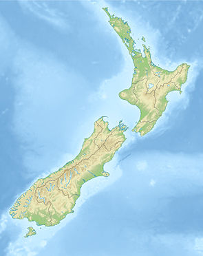
| Coordinates | 40 ° 53 ′ S , 175 ° 22 ′ E | |
| Country : | New Zealand | |
| Region (s) : | Wellington , Manawatu-Wanganui | |
| Location: | northeast of Upper Hutt and southwest of Palmerston North | |
| Protected area | ||
| Protected area type: | Forest Park | |
| Founded: | 1954 | |
| expansion | ||
| Number of areas: | 1 | |
| Length : | approx. 85 km | |
| Width : | Max. 25 km | |
| Area : | 1 165.35 km² | |
| Mountains : | Tararua Range | |
| Rivers : | Mangahao River , Otaki River , Waiohine River , Waiotaoru River , Ruamahanga River , Waingawa River , Hector River | |
| The Office Department of Conservation | ||
| Office: |
Kapiti Wellington Visitor Center 18 - 32 Manners Street Wellington 6011 |
|
| Photography from Forest Park | ||
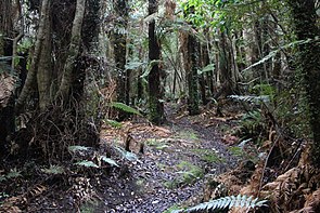
 Forest path between Otaki Forks and Field Hut |
||
The Tararua Forest Park is a standing reserve forests in the region Wellington on the North Island of New Zealand . The park is subordinate to the Department of Conservation .
geography
The Tararua Forest Park extends over the mountains of the Tararua Range in a northeast-southwest orientation. From almost sea level in the west, the mountains of the 116,535 hectare park rise to the east to a maximum height of 1571 m . The park has a length in north-northeast-south-south-west direction of approx. 85 km and at its widest point in east-west direction measures around 25 km. Flanked by the two national roads New Zealand State Highway 1 in the west and New Zealand State Highway 2 in the east, the park in the north ends 15 km south of Palmerston North and the South also from the State Highway 2 limited to that of Featherston Coming next leads to Upper Hutt .
history
At the end of the 1930s the idea arose to designate the mountainous landscape of the Tararua Range as a national park in order to celebrate the hundredth anniversary of the signing of the Treaty of Waitangi in 1940 . With the passing of the National Parks Act 1952 , the idea came up again, but was not fully supported by the Federated Mountain Club of New Zealand and local hiking clubs. Instead, two years later, the proposal of the then New Zealand Forest Service was accepted to give the forest area the status of a forest park. Acceptance of the proposal was achieved by setting up the Tararua Forest Park Advisory Committee for the management and supervision of the forest, which could decide on the priorities of measures. In the following years the network of trails and the number of huts for overnight stays were steadily expanded and expanded. At the same time, the number of roe deer increased, which led to considerable damage in the forest. At the beginning of the 1970s, hunting for game developed so that its population could be contained again.
With the passage of the Conservation Act in 1987, Tararua Forest Park was designated as a Conservation Park under Section 19 of the Act and henceforth subordinated to the Department of Conservation .
literature
- New Zealand Touring Atlas . 5th edition. Hema Maps , Brisbane 2015, ISBN 978-1-877302-92-3 (English).
Web links
- Tararua Forest Park . Department of Conservation,accessed March 8, 2020.
- Historic Tararua Forest Park . Department of Conservation,accessed March 8, 2020.
- RG Lentle, KJ Stafford, MA Potter, BP Springett, DW Dunning : An analysis of a recreational hunter's red deer tallies in the Tararua Ranges, North Island, New Zealand . In: New Zealand Journal of Ecology . 24 (1) , January 2000, pp. 11–18 (English, online [PDF; 595 kB ; accessed on February 17, 2020]).
Individual evidence
- ^ A b New Zealand Touring Atlas . 2015, p. Map 29 - Map 34 .
- ↑ Lentle, et al. a. : An analysis of a recreational hunter's red deer tallies in the Tararua Ranges, North Island, New Zealand . 2000, p. 12 .
- ↑ Coordinates and longitudes were determined using Goggle Earth Pro Version 7.3.2.5776 on March 8, 2020
- ↑ a b Historic Tararua Forest Park . Department of Conservation , accessed March 8, 2020 .
