Aorangi Forest Park
| Aorangi Forest Park | ||
| Geographical location | ||
|
|
||
| Coordinates | 41 ° 27 ′ S , 175 ° 19 ′ E | |
| Country : | New Zealand | |
| Region (s) : | Wellington | |
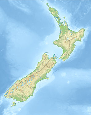
| Location: | southwest of Lake Wairarapa on the southern tip of New Zealand's North Island | |
| Protected area | ||
| Protected area type: | Forest Park | |
| Founded: | 1978 | |
| Precursor: | State Forest (1900) | |
| expansion | ||
| Number of areas: | 1 | |
| Length : | around 33 km | |
| Width : | around 14 km | |
| Area : | 194.02 km² | |
| Mountains : | Aorangi Range | |
| Rivers : | Tauanui River , Turanganui River , Whawanui River | |
| The Office Department of Conservation | ||
| Office: |
Kapiti Wellington Visitor Center 18 - 32 Manners Street Wellington 6011 |
|
| Photography from Forest Park | ||
 Putangirua Pinnacles in the western part of the park |
||
The Aorangi Forest Park is a protected forest in the Wellington region of the North Island of New Zealand . The park is subordinate to the Department of Conservation .
geography
The 19,402 hectare large forest park extends over a length of about 33 km from north to south in the mountains of Aorangi Range on the south-eastern part of the North Island of the country. At its widest point in east-west direction, the park measures around 14 km and extends at one point to the coast of Palliser Bay and in the south to the coast of the southern tip of the North Island. The highest point in the park is Mount Ross with 981 m . The forest park can be reached from New Zealand State Highway 53 from Martinborough via Lake Ferry Road , with a branch to the southeast on the east side of the park or to the coast the Palliser Bay and from there on the coast road further south, with access to the Putangirua Pinnacles and the southern part of the park.
history
In 1900, 7,730 acres of the southern part of what is now Forest Park was elevated to a State Forest . The northern part followed in 1936. Livestock farming was allowed between the two parts, but when the New Zealand Forest Service took over responsibility for the forest in June 1974 , farming ceased. In the years that followed, the Forest Service established exotic plants in order to counteract erosion of the soil. In 1978 the forest was finally designated as a Forest Park and in 1987 it was placed under the Department of Conservation .
literature
- New Zealand Touring Atlas . 5th edition. Hema Maps , Brisbane 2015, ISBN 978-1-877302-92-3 (English).
Web links
- Aorangi Forest Park . Department of Conservation,accessed March 16, 2020.
Individual evidence
- ↑ Simon Nathan : National and Conservation Parks . In: Te Ara - the Encyclopedia of New Zealand . Ministry for Culture & Heritage , August 3, 2015, accessed March 16, 2020 .
- ↑ a b Coordinates and longitudes were determined using Goggle Earth Pro Version 7.3.2.5776 on March 16, 2020
- ^ New Zealand Touring Atlas . 2015, p. Map 33 .
- ^ Aorangi Forest Park . Department of Conservation , accessed March 16, 2020 .
