Victoria Forest Park
| Victoria Forest Park | ||
| Geographical location | ||
|
|
||
| Coordinates | 42 ° 10 ′ S , 172 ° 3 ′ E | |
| Country : | New Zealand | |
| Region (s) : | West coast | |
| Location: | southeast of the mountain ranges of the New Zealand Alps | |
| Protected area | ||
| Protected area type: | Forest Park | |
| expansion | ||
| Number of areas: | 1 | |
| Area : | 2 060 km² | |
| Mountains : | Victoria Range | |
| Lakes : | Lake Daniel | |
| Rivers : | Montgomerie River | |
| The Office Department of Conservation | ||
| Office: |
Reefton i-SITE Visitor Information Center 67-69 Broadway Reefton |
|
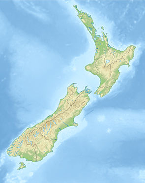
Victoria Forest Park is a forest reserve in the West Coast region in the north of New Zealand's South Island . With 206,000 hectares , it is the largest forest park in the country.
Geography and geology
In the area of the park there are two extensive mountain ranges, the Victoria Range in the east and the Brunner Range in the west. The mountain ranges consist of heavily folded greywacke and clay slate , which are criss-crossed by faults and which at Reefton contain gold-bearing quartz.
The area is drained by the Inangahua River to the west and the Maruia River , both of which flow into the Buller River , which runs north of the park . The Upper Gray River runs along the south edge of the park.
The park is surrounded by several highways, which, however, correspond to a German federal highway when it is expanded. State Highway 65 runs to the east, a section of State Highway 6 to the north, State Highway 69 and State Highway 7 to the west , which cuts through the park from Reefton to Springs Junction .
In the park itself there is a network of paths that were often laid out when the area was used for mining. The park area is largely uninhabited forest.
Flora and fauna
The forest is beech and several species illusory beeches , including Silver Sparkle Beech Mountain Beech ( Nothofagus solandri var. Solandri ), black beech ( Nothofagus solandri var. Cliffortioides ) and hard beech ( Nothofagus truncata dominated).
The bird world includes Tui Korimako ( Anthornis melanura ), Maori flycatchers , Kaka and parrots as well as the Haastkiwi .
history
There was little Māori settlement in the area. The first European settler to permanently settle here in 1861 was the farmer Samuel Mackley.
In 1870, gold-bearing quartz began to be mined in the area south of Reefton. 50 mines were registered in the first 18 months. The largest of the mines was the Waiuta mine, which operated until 1951. Reefton experienced strong growth as a result of the need for food, wood and coal for mining. Reefton was connected to the telegraph network in 1872 and was the first place in New Zealand to have electric street lights in 1888.
One by Ocean Gold Ltd. operating gold mine is located east of Reefton. Coal will also continue to be mined.
tourism
The park becomes panning for gold , mountaineering, hunting. Mountain biking , excursions with four-wheel drive vehicles and hiking are used. The hiking trails range from short trips to multi-day hikes. Several small huts in the park offer accommodation.
In the area there are remnants of previous mining activities.
