Ruahine Forest Park
| Ruahine Forest Park | ||
| Geographical location | ||
|
|
||
| Coordinates | 39 ° 45 ′ S , 176 ° 8 ′ E | |
| Country : | New Zealand | |
| Region (s) : | Manawatu-Wanganui , Hawke's Bay | |
| Location: | northeast of Palmerston North | |
| Protected area | ||
| Protected area type: | Forest Park | |
| Founded: | 1976 | |
| expansion | ||
| Number of areas: | 1 | |
| Length : | approx. 100 km | |
| Width : | Max. 24 km | |
| Area : | 930.56 km² | |
| Mountains : | Ruahine Range , Mokai Patea Range , Whanahuia Range | |
| Rivers : | Mangatera River , Makaroro River , Waikamaka River , Waipawa River , Kawhatau River , Pourangaki River , Tukituki River , Pohangina River , Tamaki River | |
| The Office Department of Conservation | ||
| Office: |
Te Papaioea / Palmerston North Office 28 North Street Palmerston North 4410 |
|
| Photography from Forest Park | ||
 Ruahine Range , on the eastern flank of the mountains |
||
 On the way to Daphne Hut (on the eastern flank of the mountains) |
||
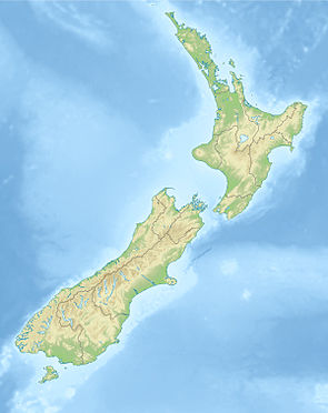
The Ruahine Forest Park is a standing reserve forests in the regions Manawatu-Wanganui and Hawke's Bay , on the North Island of New Zealand . The park is subordinate to the Department of Conservation .
Origin of name
The name “ Ruahine ” is said to mean something like “wise woman” in the Māori language and was a great granddaughter of the Kaitaki leader of the Aotea Waka .
geography
The Ruahine Forest Park extends over the mountains of the Ruahine Range in a north-northeast-south-southwest direction for a length of approximately 100 km, starting 45 km west of Napier and ending approximately 15 km northeast of Palmerston North . At its widest point, the park measures around 24 km in an east-west direction. Part of the Mokai Patea Range and the Whanahuia Range also belong to the park. The highest elevation in the park is the Mangaweka with a height of 1733 m . The total area of the park covers an area of 93,056 hectares , which is overgrown with forest except for the ridges of the highest elevations.
history
The area of the Ruahine Forest was granted forest park status in 1976 .
literature
- New Zealand Touring Atlas . 5th edition. Hema Maps , Brisbane 2015, ISBN 978-1-877302-92-3 (English).
Web links
- Ruahine Forest Park . Department of Conservation,accessed March 7, 2020.
Individual evidence
- ↑ a b History and culture . Department of Conservation , accessed March 7, 2020 .
- ↑ Coordinates and longitudes were determined using Goggle Earth Pro Version 7.3.2.5776 on March 7, 2020
- ^ New Zealand Touring Atlas . 2015, p. Map 27, Map 31 .
- ^ The Ruahine Forest Park . In: House of Representatives (ed.): Parliamentary Debates . Volume 440 . Wellington Aug. 14, 1981, p. 2696 (English).
