Pirongia Forest Park
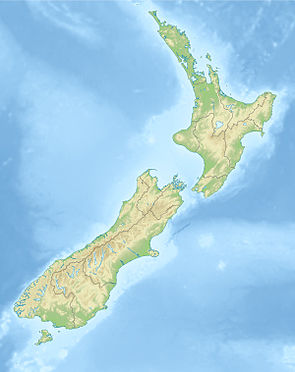
| Pirongia Forest Park | ||
| Geographical location | ||
|
|
||
| Coordinates | 37 ° 58 ′ S , 175 ° 3 ′ E | |
| Country : | New Zealand | |
| Region (s) : | Waikato | |
| Location: | southwest of Hamilton to the west coast of the North Island down | |
| Protected area | ||
| Protected area type: | Forest Park | |
| Founded: | 1971 | |
| expansion | ||
| Number of areas: | 5 | |
| Area : | 135 km² | |
| Rivers : | Oparau River | |
| The Office Department of Conservation | ||
| Office: |
Te Rapa Office 5 Northway St Te Rapa Hamilton 3200 |
|
| Photography from Forest Park | ||
 Section of a forest in the Pirongia Forest Park |
||
The Pirongia Forest Park is a standing reserve forests in the region Waikato on the North Island of New Zealand . The park is subordinate to the Department of Conservation .
geography
The 13,500 hectares comprehensive Forest Park is located five individual areas about 22 kilometers southwest of Hamilton . By far the largest part of the park is around 7 km east of Aotea Harbor and has a length of around 22 km in a north-west-south-east direction and is around 12 km at its widest point. The two highest peaks in the park are the Pirongia with 959 m and The Cone, a good 1 km west of it, with 953 m . Around 12 km northwest of the large part of the park there is another 5 × 4 km area of the park directly on the coast around the 756 m high Mount Karioi and another 7.5 × 3 km area, Tapuwaehounuku, around 6 km south-southwest called.
The Pirongia Forest Park can be reached via the New Zealand State Highway 39 , which comes from Otorohanga via the town of Pirongia to the east of the park or via the two New Zealand State Highway 23 and 31 , which provide access to the park to the north and south.
history
The core of the Pirongia Forest Park was established in 1971, the area around Mount Karioi was added in 1976 and the area of Tapuwaehounuku in 1984 . In 1987 the park was handed over to the Department of Conservation for maintenance and management .
literature
- New Zealand Touring Atlas . 5th edition. Hema Maps , Brisbane 2015, ISBN 978-1-877302-92-3 (English).
- Martin Fisher : The Environmental Management of Pirongia Forest Park with a Focus on the Period since 1970 . In: Waitangi Tribunal . Wai 898, # A151. Ministry of Justice , Wellington April 2014 (English, online [PDF; 3.2 MB ; accessed on March 2, 2020]).
Web links
- Pirongia Forest Park . Department of Conservation,accessed March 2, 2020.
- Pirongia and Raglan tracks . (PDF; 4.8 MB)Department of Conservation, September 2011,accessed on March 2, 2020.
- alesik2u: Pirongia Forest Park ( Waikato , New Zealand ). (Video 0:42 min) Youtube , October 12, 2009, accessed on March 2, 2020 (English, a panoramic view of part of the forest area).
Individual evidence
- ^ Pirongia and Raglan tracks . (PDF; 4.8 MB) Department of Conservation , September 2011, accessed on March 2, 2020 .
- ^ A b New Zealand Touring Atlas . 2015, p. Map 11 .
- ↑ Coordinates and longitudes were determined using Goggle Earth Pro Version 7.3.2.5776 on March 2nd, 2020
- ^ A b Fisher : The Environmental Management of Pirongia Forest Park with a Focus on the Period since 1970 . 2014, p. ix .
- ^ Fisher : The Environmental Management of Pirongia Forest Park with a Focus on the Period since 1970 . 2014, p. 2 .
