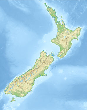
Lake Sumner Forest Park
| Lake Sumner Forest Park | ||
| Geographical location | ||
|
|
||
| Coordinates | 42 ° 34 ′ S , 172 ° 17 ′ E | |
| Country : | New Zealand | |
| Region (s) : | Canterbury | |
| Location: | around 90 km north-northwest of Christchurch on the east side of the New Zealand Alps | |
| Protected area | ||
| Protected area type: | Forest Park | |
| Founded: | 1974 | |
| expansion | ||
| Number of areas: | 9 | |
| Length : | approx. 90 km | |
| Area : | 1 051.32 km² | |
| Mountains : | Libretto Range , Doubtful Range , The Nelson Tops , Glynn Wye Range , Crawford Range , Studleight Range | |
| Lakes : | Lake Sumner | |
| Rivers : | Lewis River , Nina River , Doubtful River , Boyle River , Hope River , Hurunui River , Glenrae River | |
| The Office Department of Conservation | ||
| Office: |
Rangiora Office 32 River Road Rangiora 7400 |
|
| Photography from Forest Park | ||
 Gabriel Hut in Lake Sumner Forest Park |
||
The Lake Sumner Forest Park is a standing reserve forests in the region Canterbury on the South Island of New Zealand . The park is subordinate to the Department of Conservation .
geography
The area of Lake Sumner Forest Park , which is located around 100 km northwest of Christchurch , extends for around 60 km from the north on the east side of the New Zealand Alps , starting at Lewis Pass , over which the New Zealand State Highway 7 runs in a south-south-west direction to the headwaters of the Lucy Stream , a southern tributary of the North Esk River , both of which can be found in the mountains of the Dampier Range . To the north and northwest is the Victoria Forest Park, to the southwest is Arthur's Pass National Park and east of the park continues with the Hanmer Forest Park, the protected forest of the mountain ranges.
The mountain ranges in the park area include, from north to south, the Libretto Range , Doubtful Range , The Nelson Tops , Glynn Wye Range , Crawford Range, and Studleight Range . The Lake Sumner , the namesake of the Forest Park is located in the southern part of the park.
history
The park was established in 1974.
literature
- New Zealand Touring Atlas . 5th edition. Hema Maps , Brisbane 2015, ISBN 978-1-877302-92-3 (English).
Web links
- Lake Sumner Forest Park . Department of Conservation,accessed March 30, 2020.
- Lake Sumner and Lewis Pass . (PDF; 2.4 MB)Department of Conservation, 2010,accessed on March 30, 2020.
Individual evidence
- ↑ Lake Sumner and Lewis Pass . (PDF; 2.4 MB) Department of Conservation , 2010, accessed on March 30, 2020 .
- ↑ a b c New Zealand Touring Atlas . 2015, p. Map 46, Map 47, Map 52 .
- ↑ Coordinates and longitudes were determined using Goggle Earth Pro Version 7.3.2.5776 on March 29, 2020
- ↑ Simon Nathan : National and Conservation Parks . In: Te Ara - the Encyclopedia of New Zealand . Ministry for Culture & Heritage , August 3, 2015, accessed March 30, 2020 .
