Remutaka Forest Park
| Remutaka Forest Park | ||
| Geographical location | ||
|
|
||
| Coordinates | 41 ° 18 ′ S , 175 ° 4 ′ E | |
| Country : | New Zealand | |
| Region (s) : | Wellington | |
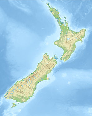
| Location: | east of Wellington | |
| Protected area | ||
| Protected area type: | Forest Park | |
| Founded: | 1972 | |
| expansion | ||
| Number of areas: | 1 | |
| Length : | around 40 km | |
| Width : | Max. 16 km | |
| Area : | around 220 km² | |
| Mountains : | Remutaka Range | |
| Rivers : | Pakuratahi River , Waiorongomai River , Orangorongo River | |
| The Office Department of Conservation | ||
| Office: |
Kapiti Wellington Visitor Center 18 - 32 Manners Street Wellington 6011 |
|
| Photography from Forest Park | ||
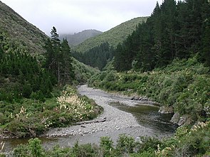
 northern part of the park on the Pakuratahi River |
||
The Remutaka Forest Park is a standing reserve forests in the region Wellington on the North Island of New Zealand . The park is subordinate to the Department of Conservation .
Name changes
In October 2017, the New Zealand Geographic Board changed the spelling of all geographical names that included the name “ Rimutaka ” to “ Remutaka ”, which in the Māori language means “ place or place to sit ”. The previously used spelling of the name made no sense to the natives of the country.
geography
The approximately 22,000 hectare contiguous park is located more in the eastern mountains of the Remutaka Range , between Wellington Harbor , Lower Hutt and Upper Hutt in the west and Lake Wairarapa and the Raumahanga River in the east. The mountains and the park have a southwest-northeast orientation and are bounded in the south by Palliser Bay and in the north on New Zealand State Highway 2 . The highest point of the mountain range is in the southeastern part of the park and comes with Mount Matthews at an altitude of 941 m . The park itself extends over a length of 40 km and measures one of its widest points in the southern part around 16 km.
The park can be reached from the west via the south-eastern suburbs of Lower Hutt and from the north via New Zealand State Highway 2 .
history
The forest of the Remutaka Range was designated as a Forest Park in 1972 and thus received protection status, and in May 2006 the Remutaka Forest Park Trust began to reintroduce the North Island Brown Kiwi to the park.
literature
- New Zealand Touring Atlas . 5th edition. Hema Maps , Brisbane 2015, ISBN 978-1-877302-92-3 (English).
Web links
- Remutaka Forest Park . Department of Conservation,accessed March 13, 2020.
- Remutaka Forest Park . (PDF; 2.25 MB)Department of Conservation, June 2018,accessed on March 13, 2020(English, flyer).
Individual evidence
- ^ Piers Fuller : Slow progress on the long and winding road from Rimutaka to Remutaka . In: Stuff . Fairfax Media , April 10, 2018, accessed March 13, 2020 .
- ↑ Piers Fuller : Remutaka correct spelling, says iwi . In: Dominion Post . Fairfax Media , April 23, 2014, accessed March 13, 2020 .
- ↑ Remutaka Forest Park . Department of Conservation , accessed March 13, 2020 .
- ^ New Zealand Touring Atlas . 2015, p. Map 33 .
- ↑ Coordinates and longitudes were determined using Goggle Earth Pro Version 7.3.2.5776 on March 12, 2020
- ↑ Simon Nathan : National and Conservation Parks . In: Te Ara - the Encyclopedia of New Zealand . Ministry for Culture & Heritage , August 3, 2015, accessed March 13, 2020 .
- ^ Nature and history . Department of Conservation , accessed March 13, 2020 .
