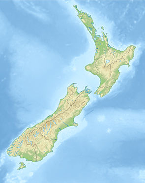
Lindis Conservation Area
| Lindis Conservation Area | ||
| Geographical location | ||
|
|
||
| Coordinates | 44 ° 32 ' S , 169 ° 39' E | |
| Country : | New Zealand | |
| Region (s) : | Canterbury | |
| Location: | east of Lake Hāwea and west of the Dunstan Range | |
| Protected area | ||
| Protected area type: | Conservation Area | |
| expansion | ||
| Number of areas: | 1 | |
| Length : | 12.5 km | |
| Width : | Max. 4.8 km | |
| Area : | approx. 50 km² | |
| The Office Department of Conservation | ||
| Office: |
Te Manahuna / Twizel Office 15 Wairepo Road Twizel 7901 |
|
| Photography from the Conservation Area | ||
 Longslip Mountain , part of the Lindis Conservation Area |
||
The Lindis Conservation Area is a protected area in the Canterbury region of the South Island of New Zealand . The area is under the Department of Conservation .
geography
The Lindis Conservation Area is located around 25 km east of Lake Hāwea and northwest of the Dunstan Range , at an altitude between 820 m and 1664 m . The highest point is here the Dromedary Hill . The Conservation Area is bordered to the south by the Lindis Pass Scenic Reserve , stretching from the northern flank of the 1323 m high double peak on the approximately 960 m lying Lindis Pass km with a total of around 2 to Extends north.
The Lindis Conservation Area has a maximum length of 12.5 km starting from the Lindis Pass Scenic Reserve and measures around 4.8 km at its widest point in an east-west direction.
The New Zealand State Highway 8 crosses from the west over the Lindis Pass the reserve of the Lindis Pass Scenic Reserve and touches the Lindis Conservation Area at its southernmost tip and less than 2 km at its south-eastern side to recoil and then to the northeast. From the State Highway , some hiking trails lead into the Lindis Conservation Area . The most important routes are the Melina Ridge Track , which touches the area in the south, and the Pavilion Peak Track , which crosses part of the northern area of the reserve.
literature
- Discover the Lindis region . (PDF; 2 MB)Department of Conservation, 2010,p. 9,accessed on May 7, 2020(English).
Web links
- Lindis Conservation Area . Department of Conservation,accessed May 7, 2020.
- Lindis Conservation Area Map . (PDF; 323 kB)Department of Conservation,accessed on May 7, 2020(English).
Individual evidence
- ↑ Topo maps . Land Information New Zealand , accessed May 7, 2020 .
- ↑ Coordinates and longitudes were determined using Goggle Earth Pro Version 7.3.2.5776 on May 7, 2020
- ^ New Zealand Touring Atlas . 5th edition. Hema Maps , Brisbane 2015, ISBN 978-1-907302-92-3 , pp. Map 66 (English).
- ↑ Lindis Pass . In: NZ Topo Map . Gavin Harriss , accessed May 7, 2020 .
- ↑ Discover the Lindis region . Department of Conservation , 2010, p. 9 , accessed May 7, 2020 .
