Mannheim Forest Park
|
Landscape protection area "Waldpark"
|
||
|
Forest park with mostly loose forest |
||
| location | Mannheim in Baden-Württemberg , Germany | |
| surface | 149.7 ha | |
| Identifier | 2.22.006 | |
| WDPA ID | 325614 | |
| Geographical location | 49 ° 27 ' N , 8 ° 27' E | |
|
|
||
| Setup date | May 2nd 1975 | |
| administration | City administration Mannheim | |
The Mannheim Forest Park is a near-natural recreation area and landscape protection area on the Rhine in the southwest of the city of Mannheim in Baden-Württemberg . In the colloquial, broader sense, “forest park” refers to the entire wooded area there, in the narrower sense to the landscape protection area.

Geographical location
The "Waldpark" landscape protection area, originally about 167 hectares in size, includes the Rhine promenade, forest park, lido and Schindkaut in the area of an arc of the Rhine in the southwest and west of the Mannheim districts of Lindenhof , Niederfeld and Neckarau . It has an extension of about 3 km in the north-south direction and an extension of about 2.6 km at the widest point in the east-west direction.
Spatial limitation
The area starts at Rhine-km 417.245, only slightly downstream from the large power plant in Mannheim , and thence along the Rhine, past the nature reserve " In the white poplar ," and then closes the beach with one to Rhein-km 420.040, where the nature reserve " tear Island “Begins. The area runs along the southern border of the fenced -in Riss Island to the Altrheinarm "Bellenkrappen" (" curved arm overgrown with poplars ") and along its eastern bank and then along the Rhine to Rhine km 423.020 at Emil-Heckel-Strasse as the northernmost Point. From there, the eastern border runs south along the Waldparkdamm, then along the flood dam to the Kiesteichweg and then on the flood dam to the starting point on the Rhine.
Restrictions
Due to the requirements of the landscape protection, all changes are prohibited in the area that "deface the landscape or damage nature or impair the enjoyment of nature." This includes, among other things, the construction and modification of structures, laying of lines, excavations, changes to the shape of the ground, or Change of paths and streets, tents, as well as deposits.
Natura 2000 site
Since the beginning of 2006 the forest park has been part of the fauna-flora-habitat area "Rhine lowlands from Philippsburg to Mannheim" (FFH area 6716-341) and since 2010 part of a bird sanctuary. As part of the Natura 2000 network, it is subject to the transnational protection of endangered wild native plant and animal species and their natural habitats.
Recreation room
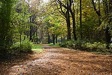
In popular parlance, the area that includes the protected areas "Forest Park", "Reiss Island" and "At the Silver Poplar" is usually referred to under the generic term as "Forest Park". Together they lie in a loop of the Rhine, for which no structural protection against flooding by Rhine floods was built. This results in a natural exchange of plants and animals and leads to a special biodiversity in an alluvial forest as a habitat.
Despite its natural character, the forest park is well developed with numerous paths for recreation on foot close to the city, including seating and resting places. Some paths are also open to cycling. Therefore, the forest park is often used by walkers, joggers and those looking for relaxation on their bikes and is one of the most popular excursion destinations close to the city. A bridle path also leads through the forest park, starting from a nearby equestrian club.
Although bathing in the Rhine is prohibited, the Mannheimer Strandbad serves as a popular excursion destination with a large sunbathing area, a designated barbecue area and two restaurants. The lido was opened in 1927 as a free beach.
Historical
The forest park was not originally owned by Mannheim, but was a community forest of the still independent community of Neckarau, south of Mannheim. The Neckarau Forest not only included the forest area in the Rhine bend, but also stretched more loosely wooded up to the vicinity of Neckarau, where it was referred to as the “bush”. As early as 1798 a ban was issued to cut wood without a permit. At the beginning of the 19th century, however, major deforestation took place in order to pay war debts and to win fascines for hydraulic engineering measures. A Rhine breakthrough was also being planned - a project which, after Prussia's concerns, was finally abandoned in 1832. After the yield for arable farming was estimated to be more favorable, the "Stollenwörth" and later also the "Rottfeld" ( cleared field) were cut down. So the area that is still wooded today remained.
The city of Mannheim showed great interest in the Neckarau Forest as a recreational area for its residents from around 1870. Neckarau allowed Mannheim to set up benches at its own expense. After the incorporation of Neckarau (1899), the name was changed to "Forest Park" in 1905, especially since large areas of meadow were created through clearing and clearing.
The park concept was pursued further. In 1911, the “Stern” restaurant went into operation at the central point of the forest park, which had a hall for up to 400 guests and up to 2000 seats in a garden area. After the death of the first owner, the restaurant was sold and continued in 1920, and in 1931 it was even allowed to drive there. From around 1930 an animal park added two circus lions (donated by the Sarrasani Circus ), bears, monkeys, birds and riding donkeys. In 1944, an air mine severely damaged the building. In the 1950s, the building, which was further damaged by floods, was torn down.
Renaturation
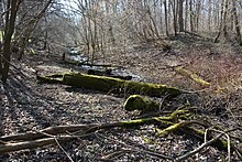
In 2015 the "hose ditch" leading through the forest park was renatured. This narrow arm of the old Rhine had been partially silted up for years. It was connected to the “Hagbau” Schlute in order to improve the water morphology in the southern nature reserve “Bei der Silberpappel” at Rhine kilometer 418.6 . For the benefit of the local amphibian fauna, the expectation is that on around 155 days a year water will flow through the “hose ditch” to the “Bellenkrappen” and from there on into the Rhine.
See also
Web links
- 2.22.006 Forest Park. Landscape protection area profile. LUBW State Institute for the Environment, Measurements and Nature Conservation Baden-Württemberg, accessed on April 28, 2015 .
- World Database on Protected Areas - Waldpark Mannheim (English)
Individual evidence
- ↑ a b Ordinance of the Mannheim Mayor's Office as the lower nature conservation authority on the "Waldpark" nature reserve. (PDF 34 kB) City of Mannheim, May 2, 1975, accessed on April 28, 2015 .
- ↑ cf. Probst, Hansjörg: Seckenheim: History of a Kurpfälzer Village - Mannheim, 1981. In: Heidelberg historical stocks - digital. Heidelberg University Library, p. 99 , accessed on September 23, 2018 (No. 189, the word “Krappen”).
- ↑ Profiles of the Natura 2000 areas. 6716-341 Rhine lowland from Philippsburg to Mannheim (FFH area). Federal Agency for Nature Conservation, accessed on June 19, 2019 .
- ^ Hansjörg Probst : 7. The Neckarau Forest. In: Neckarau (Volume 1): From the beginnings to the 18th century - Mannheim, 1988. pp. 30 ff. , Accessed on July 6, 2015 .
- ↑ Mannheimer Morgen from January 3, 2019, page 30.
- ↑ Mannheimer Morgen of January 11, 2020, page 12.
- ↑ Wolf Engelen: Our Lindenhof , Citizens Interest Community Lindenhof [Hrsg.], Mannheim, 1996, page 28, ISBN 3-923003-75-7 .
- ↑ Mannheimer Morgen of January 21, 2015, page 18.


