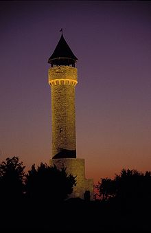
Wartberg Tower (Alzey)
The Wartberg Tower near the Rhineland-Palatinate town of Alzey in Germany is a 28.15 meter high observation tower . It was first mentioned in a document in 1420 and served as an observation post for military purposes.
Geographical location
The Wartberg tower stands about two kilometers south of the city center on the northeast slope of the Wartberg ( 285 m above sea level ) at 275 m above sea level. Not far past the tower, the old Kaiserstraße , today Landesstraße 401, leads to the federal motorway 63 and from there to Morschheim . Beyond this road is about 350 meters west of Wartberg tower at 49 ° 43'58 "N, 8 ° 6'17" E a 57 meter high telecommunications tower of Deutsche Telekom .
history
The Wartberg Tower was probably built in the first half of the 12th century and was part of a medieval "early warning system". During the Thirty Years War the tower was destroyed in 1620 and in 1668 it was rebuilt. Renovation work took place in 1858 and 1890; in the latter, the tower was redesigned.
Towards the end of the Second World War , on January 8, 1945, the Wartberg Tower was - according to legend - the savior of the city . American bomber pilots mistakenly thought that the top protruding from the fog was the church tower of St. Nicholas' Church and dropped their bomb load. The only thing that is certain is that the tower was destroyed and the city was largely spared from bombing raids. A total of 42 buildings were destroyed and more than 180 damaged in World War II.
Reconstruction took place in 1960 under Mayor Wilhelm Bechtolsheimer . On February 22, 1970, a strong storm brought the tower down again.
In 1985 the ACV - Verein für Customsspflege - was given the sponsorship for the renewed reconstruction. With the support of Alzeyer citizens, associations and the state of Rhineland-Palatinate, the foundation stone was laid on July 2nd, 1988. Mayor Walter Zuber inaugurated the completely renovated Wartberg tower on August 26, 1989 .
Possibility of viewing
From the Wartberg tower you can look across the Rheinhessen hill country to the Petersberg , in the opposite direction to the Donnersberg in the northern Palatinate , to the Soonwald in the Hunsrück in the northwest and to the Taunus in the north and northeast. When visibility is good, the skyline of Frankfurt am Main can also be seen.
literature
- City of Alzey (ed.): Festschrift for the inauguration celebrations on the occasion of the rebuilding of the Wartberg tower from August 25 to 27, 1989, Alzey 1989.
Web links
- Wartbergturm Alzey on warttuerme.de
- Panoramic view from the Wartberg tower on www.panorama-photo.net
Individual evidence
- ↑ Monument topography of the Federal Republic of Germany : Cultural monuments in Rhineland-Palatinate Volume 20.2: District of Alzey-Worms . City of Alzey . Published on behalf of the Ministry of Education, Science, Further Education and Culture by the General Directorate for Cultural Heritage Rhineland-Palatinate Directorate State Monument Preservation. Edited by Michael Huyer and Dieter Krienke. Wernersche Verlagsgesellschaft : Worms 2014. ISBN 978-3-88462-326-8 ; P. 46
Coordinates: 49 ° 43 ′ 59 ″ N , 8 ° 6 ′ 34 ″ E
