Wassiljewka (Saratov, Marx)
| Village
Wassiljewka / Basel
Васильевка
|
||||||||||||||||||||||||||||
|
||||||||||||||||||||||||||||
|
||||||||||||||||||||||||||||
Wassiljewka ( Russian Васи́льевка ; German name Basel , Russian Базель ) is a place in the Saratov Oblast in Russia .
geography
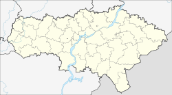
The village is located on the left bank of the Volga , the so-called "meadow side", about 90 km as the crow flies northeast of Saratov . It belongs to the rural community Sorkinskoje selskoje posselenije, whose seat is in the two kilometers southwest of the village of Sorkino (formerly German Zurich), and with this to the Rajon Marx . The city of Marx , the former Baronsk or Jekaterinenstadt, is about 40 km southwest of the village.
history
According to various sources, the place was founded in the years 1764–1766 or 1767 by Baron Caneau de Beauregard as a Lutheran -Volga-German colony. In contrast to some other colonies founded at that time, the place received its German name Basel when it was founded , and the name Kratz ( Кратц ), after the first village chief, was initially used as an alternative. During the First World War , the tsarist government ordered the abolition of all place names of German origin in the Volga region in 1915, and Basel was given the Russian name Wassiljewka. There was a Lutheran church and three schools in the village.
After the October Revolution , the old name Basel was officially used again, and after the creation of the Autonomous Socialist Soviet Republic of the Volga Germans ( Volga German Republic ) in 1924, the place belonged to their canton of Marxstadt. After an administrative reform in 1935, the village belonged to the Unterwalden canton, which was spun off from Marxstadt canton until the republic was dissolved in 1941 (the place Unterwalden is now called Podlesnoje ).
Population development
| year | Residents |
|---|---|
| 1767 | 83 |
| 1772 | 166 |
| 1788 | 251 |
| 1798 | 295 |
| 1816 | 512 |
| 1834 | 905 |
| 1850 | 1306 |
| 1857 | 1476 |
| 1910 | 4864 |
| 1926 | 2550 |
As a result of the Russian Civil War and its aftermath, the entire Volga German population was decimated by a third, which is also reflected in the declining population of Basel.
Infrastructure
The road R226 (not yet completed on all sections) from Samara along the left bank of the Volga via Engels (across from Saratov) to Wolschski (across from Volgograd ) passes directly southeast of the town.
Web links
- Basel on the website of the Center for Volga German Studies of the Lutheran Concordia University in Portland (Oregon) (English)
- History of Basel (Russian)

