Weiherkopf
| Weiherkopf | ||
|---|---|---|
|
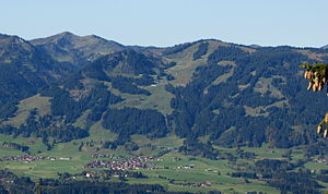
Bolsterlanger Horn and Weiherkopf, on the left in the background is the Riedberger Horn |
||
| height | 1665 m above sea level NHN | |
| location | Nagelfluhkette Nature Park , Oberallgäu district , Bavaria , Germany | |
| Mountains | Horn group , Allgäu Alps | |
| Coordinates | 47 ° 27 '54 " N , 10 ° 12' 4" E | |
|
|
||
| rock | Flysch | |
| First ascent | by locals | |
The Weiherkopf is a summit of the Hörnergruppe in the Allgäu Alps with an altitude of 1665 m .
geography

The summit is located within the Nagelfluhkette Nature Park . Immenstadt is to the north and Fischen im Allgäu to the east . Oberstdorf is in the southeast and Balderschwang to the west . Nearby peaks are the Bolsterlanger Horn in the southwest and the Rangiswanger Horn in the north.
character
The Weiherkopf is a “relatively mighty summit, half with open pastures, half covered with forest”, which is known for its extensive view from the Grünten to the Großer Widderstein .
History of the mountain name

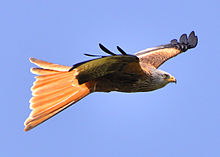
In maps of the 18th century the mountain is referred to as Veier , in the topographic map of Fischen from 1940 onwards as Weiher Kopf . "A pond, to which the name will presumably go back, could no longer be determined." Thaddäus Steiner therefore thinks it is highly conceivable that the mountain could once have been called Weihenkopf . "This addition to the name would mean 'head on which consecrations like to hang out', e.g. fork consecration". Gabelweihe is an old name for the red kite .
Tourism and development
Cableways
The six- seater gondola lift Hörnerbahn with two sections opens up the Weiherkopf from Bolsterlang . The first section of the cable car leads to the middle station at an altitude of 1350 m , the starting point for various hiking trails around the Weiherkopf. The second section leads from the middle station to the 1540 m high Horngrat between the Bolsterlanger Horn and the Weiherkopf.
In the summer of 2013, the 40-year-old Weiherkopf T-bar lift was replaced by a modern detachable 6-seater Weiherkopf chairlift .
The Weiherkopf is used by paragliders as a launch site in both summer and winter .
summer
In the summer season it is possible to hike on a panoramic path between the peaks. An intermediate destination is the Weiherkopf. The main path is called the Allgäuer Hörnertour , which is also used in winter, but is not marked or signposted.
winter
In the winter season it is possible to ski and snowboard from the summit on an FIS downhill and slalom run.
The area around the Weiherkopf is also popular for touring skiers and snowshoe fans.
literature
- Weiherkopf and Großer Ochsenkopf , in: Herbert Mayr, Allgäuer Alpen, Kompass Wanderführer 925, Kompass-Karten-GmbH, Rum 2005, 2nd edition, pp. 36–37, ISBN 3-85491-201-3
Web links
Individual evidence
- ↑ so Dieter Seibert in: Allgäuer Alpen and Ammergau Alps. Alpine Club Guide, ed. by the German and Austrian Alpine Club, Bergverlag Rother, Munich 2004, 16th edition, ISBN 3-7633-1126-2 , p. 146
- ^ Weiherkopf, in: Herbert Mayr, Allgäuer Alpen, Kompass Wanderführer 925, Kompass-Karten-GmbH, Rum 2005, 2nd edition, p. 36
- ↑ so: Thaddäus Steiner, Allgäuer Bergnames, Lindenberg 2007, p. 214, ISBN 978-3-89870-389-5
- ^ Thaddäus Steiner, Allgäuer Bergnames, Lindenberg 2007, p. 215
- ↑ Ski resorts modernized on bolsterlang.de, accessed on January 29, 2017.

