Wicklow
|
Wicklow Cill Mhantáin |
||
|---|---|---|
| coat of arms | map | |
 |
|
|
| County : | Wicklow County | |
| Province : | Leinster | |
| Basic data | ||
| Residents : | 6,758 (2011) | |
| Telephone code : | +353 (0) 404 | |
| Geographic location : |
Coordinates: 52 ° 59 ′ N , 6 ° 2 ′ W
approx. 42 km south of Dublin, |
|
| Official Website: | www.wicklow.ie | |
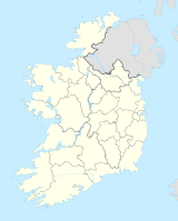
Wicklow ( Irish : Cill Mhantáin ) is a city in County Wicklow in the Republic of Ireland and the administrative seat of the county of the same name . The city is located south of the Irish capital Dublin on the east coast of Ireland. According to the 2011 census, 6,758 people live there; if you add the surrounding villages, there are 10,070.
City history
Historians believe that the city of Wicklow was founded by the Vikings around 870. The name Wicklow may come from "Vikinglow", which means " Viking pasture "; or from "Wykynlo", which means "Viking Bay" (Viking Loch / Lough). But if you consider the natural harbor and the fertile farmland, you can assume that the area was already inhabited before; There are also many monuments from the Bronze Age in the area around Wicklow .
The Irish name Cill Mhantáin has its own history. It is said that St. Patrick , the Irish national saint, attempted to land on Travelahawk Beach south of the harbor. Hostile natives attacked the newcomers, and one of the saint's group lost his front teeth in the process. He became known as the "Manntach" - the toothless. He wasn't impressed and came back to town to plant a church. "Cill Mhantáin" means "The Church of the Toothless". There is no evidence that such a man ever existed. The name is probably a toponym that describes a church above the harbor that looks like a set of teeth with gaps between its teeth.
After the invasion of the Anglo-Normans , Wicklow was given to Maurice FitzGerald as a fief . He built the Black Castle . The fortress was on the coast in the south of the port and is now in ruins. As described above, the English place name “Wicklow” has nothing to do with the Irish name. When the Normans began to dominate the area, they preferred non-Irish names. The influence can still be seen in many place names and family names.
The oldest still existing building in the city is the Franciscan monastery , it is located at the west end of the main street.
Other notable buildings include the City Hall and Gaol Prison, built in 1702 . The place of execution was also located there until the end of the 19th century. In 1799, Billy Byrne , leader of the Irish Rebellion of 1798 , was executed here. Today a statue in the market square is dedicated to him. The prison was recently renovated and is now used as a museum (heritage center). The most important building is the "East Breakwater". It was commissioned by the Wicklow Harbor Commission in the early 1880s. The architect was William George Strype, the builder John Jackson from Westminster. The Wicklow Port Commission was transferred to the Wicklow Port Company in 2002 .
At "Fitzwilliam Square" in the center of Wicklow there is an obelisk that is reminiscent of Captain Robert Halpin. He was in command of the Great Eastern cable ship and was born in Wicklow. He is considered one of the greatest seafarers of the 19th century.
geography
The town of Wicklow is in a semicircle around the harbor. In the north there is "The Murrough", a popular excursion area by the sea, in the east there is a beach. In the west there are rolling hills that rise up to the Wicklow Mountains . Wicklow Head is the most easterly point of the Republic of Ireland by land (the most easterly point of the entire island of Ireland is in Northern Ireland ).
In the south there is also a chain of sandy beaches that extend all the way to Arklow . The beaches are monitored and popular with swimmers and anglers. This also includes plenty of parking spaces for camper vans. The largest beach extends over 2 km and is called "Brittas Bay".
traffic
The city is close to National Road 11 (N11) and also has a rail link that allows commuters to travel to Dublin, 42 km away. The train also goes to Arklow, Wexford and the Rosslare ferry terminal .
The main purpose of the port of Wicklow is to import timber. It is open to the north-east and depends on the tide .
The city in the modern age
The booming Irish economy has also brought about profound changes in Wicklow since the 1990s. Many residential areas emerged in the southeast along the "Marlton Road". At the moment development has shifted to the northwest, towards the neighboring town of Rathnew. The short distance to Dublin led to the influx of many commuters to Wicklow and the surrounding areas.
Daughters and sons of the city
- Fionnuala Britton (* 1984), long distance and obstacle runner
- Peter Doyle (* 1945), racing cyclist
- FE Higgins , children's author
- Aine O'Gorman (* 1989), soccer player
literature
- Sandy Shepherd (Ed.): Illustrated guide to Ireland. Reader's Digest Association, London 1992, ISBN 0-276-42033-0
- Illustrated road book of Ireland. Second edition. Automobile Association, London 1970, ISBN 0-901088-09-9
- Jimmy Cleary & Andrew O'Brien: Wicklow Harbor: A History. Wicklow Harbor Commissioners, 2001, ISBN 0-9541147-0-1
Web links
- Map of Ireland (can be enlarged greatly)
- Wicklow Chamber of Commerce
- Wicklow's historic prison

