Wilhelmshöhe (Schonach)
| Wilhelmshöhe (Schonach) | |||
|---|---|---|---|
|
Wilhelmshöhe |
|||
| Compass direction | east | North | |
| Pass height | 975.1 m above sea level NHN | ||
| state | Baden-Württemberg | ||
| Watershed | Obertalbach → Schonach → Gutach | Elz | |
| Valley locations | Schonach in the Black Forest | Elzach - Oberprechtal | |
| expansion | State road 109 | ||
| Mountains | Black Forest | ||
| Map (Baden-Württemberg) | |||
|
|
|||
| Coordinates | 48 ° 8 '42 " N , 8 ° 10' 23" E | ||
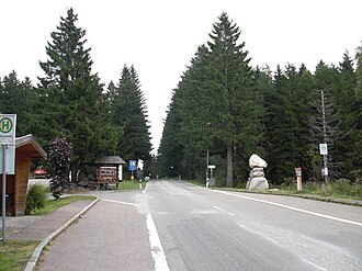
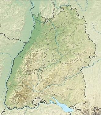
The Wilhelmshöhe is a mountain pass with 975.1 m above sea level. NHN pass in the Black Forest . It lies between Schonach in the Black Forest and Oberprechtal in the Elz Valley in the Black Forest-Baar district of Baden-Württemberg . State road 109 leads across .
geography
location
Wilhelmshöhe is located in the Southern Black Forest nature park between Schonach in the Black Forest in the eastern valley of the Gutach tributary Schonach and the Elzach district of Oberprechtal in the western Elz valley . About 200 m north of the pass is the summit of the Wilhelmshöhe elevation ( 995.1 m ), and 3.8 km southwest of the Rohrhardsberg ( 1153.2 m ).
Pass height
Directly on the mountain pass there is a road sign with the inscription: "Sea level 974 m". In the map services of the Federal Agency for Nature Conservation (BfN) the pass height “975.1” can be found.
Infrastructure and hiking
At the beginning of 1945, a mobile radio transmission system of the Deutsche Reichspost is said to have stood on Wilhelmshöhe for the distribution of French-language propaganda .
Over the mountain pass that leads Obertalstraße as a section of the national road 109, which Schonach connects Oberprechtal. The European long-distance hiking trail E1 and the Westweg (between the 7th and 8th stage) also run over it; the pass is used by hikers as a "night camp".
On the pass there is the Gasthaus Wilhelmshöhe and a bus stop.
Others
In recent years, the pass has been part of the middle route of the Black Forest Ultra Cycle Marathon .
Web links
- Wilhelmshöhe , on quaeldich.de
- Gasthaus Wilhelmshöhe , on gasthaus-wilhelmshoehe.de
Individual evidence
- ↑ a b c Map services of the Federal Agency for Nature Conservation ( information )
- ↑ Bernd-Andreas Möller (Society of Friends of the History of the Radio System ; Ulm): Radio transmitters on wheels: The mobile radio transmission systems of the Deutsche Reichspost in the years 1932 to 1945. Series of publications on radio history, Vol. 13. Verlag Rüdiger Walz, 1st edition 2003 , ISBN 9783936012026
- ↑ Wilhelmshöhe mountain pass at Gasthaus-Wilhelmshöhe, on openstreetmap.org

