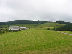
Rohrhardsberg
| Rohrhardsberg | ||
|---|---|---|
| height | 1153.2 m above sea level NHN | |
| location | Baden-Wuerttemberg , Germany | |
| Mountains | Black Forest | |
| Coordinates | 48 ° 7 '47 " N , 8 ° 7' 41" E | |
|
|
||
The Rohrhardsberg is 1153.2 m above sea level. NHN the northernmost summit of the elongated, north-south running Farnberg Plateau with several elevations over 1150 m high in the Middle Black Forest .
location
The Farnberg plateau with the Rohrhardsberg lies in the triangle between Elztal , Oberprechtal and Simonswäldertal . Its highest peaks are, south of the Rohrhardsberg, the Griesbacher Eck ( 1172 m above sea level ) and further southwest of the Obereck ( 1178 m above sea level ). The border between the district of Emmendingen in the west and the Schwarzwald-Baar district in the east runs over the summit ridge . Its highest point is the east summit of the Griesbacher Eck ( 1164 m above sea level ).
On the top of the Rohrhardsberg there is an approximately 30 m high Deutsche Telekom radio tower and, since 2004, a wind turbine .
Protected area
There are several nature reserves in the comparatively little cut area, which is characterized by large differences in altitude to the west : Rohrhardsberg-Obere Elz and the two neighboring areas of Yacher Zinken and Kostgefäll to the west . The entire area is designated as a Natura 2000 area. On the plateau ridge between the Schwedenschanze on the Rohrhardsberg and the Brend there are habitats for capercaillie and hazel grouse and other, sometimes very rare, animal and plant species. For this reason, it was agreed in the Rohrhardsberg model project to use only a narrow axis between Brend and Schwedenschanze for sporting and tourist purposes and to leave large areas largely undisturbed. Some areas should continue to be used extensively for grazing purposes, as keeping open the few poor pastures that are still preserved here would be sensible neither for economic nor for ecological reasons. Nature conservation authorities, forestry, municipalities and various user groups are successfully cooperating in this project.
In the Rohrhardsberg area, one of the first Natura 2000 management plans of the Freiburg Regional Council was completed in 2007 ; Funds from the EU's LIFE program have also been flowing into the area since 2006 to secure the Natura 2000 network . In cooperation with local farmers , a further opening of abandoned or reforested pasture fields is carried out here.
leisure
In winter, the Farnberg Ridge between Rohrhardsberg and Brend is a popular ski area; in summer, the many hiking trails of the Black Forest Association, such as B. the Zweälersteig , extensive hiking tours through the area.
See also
literature
- State Institute for Environmental Protection Baden-Württemberg [LfU] (Hrsg.): Der Rohrhardsberg. New ways in nature conservation for the Central Black Forest . Regional culture publishing house, Ubstadt-Weiher 1999, ISBN 978-3-89735-112-7 .
Web links
- Website of the life project Rohrhardsberg, Obere Elz and Wilde Gutach
- Downloads for the Natura 2000 management plan for the Rohrhardsberg at the State Institute for the Environment, Measurements and Nature Conservation Baden-Württemberg (LUBW)


