Wilmot, New Hampshire
| Wilmot | ||
|---|---|---|
 Wilmot Town Hall |
||
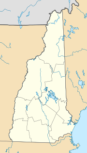
| Location in New Hampshire | ||
|
|
||
| Basic data | ||
| Foundation : | 1807 | |
| State : | United States | |
| State : | New Hampshire | |
| County : | Merrimack County | |
| Coordinates : | 43 ° 27 ′ N , 71 ° 55 ′ W | |
| Time zone : | Eastern ( UTC − 5 / −4 ) | |
| Residents : | 1,381 (as of 2017) | |
| Population density : | 18.1 inhabitants per km 2 | |
| Area : | 76.7 km 2 (approx. 30 mi 2 ) of which 76.2 km 2 (approx. 29 mi 2 ) is land |
|
| Height : | 266 m | |
| Postal code : | 03287 | |
| Area code : | +1 603 | |
| FIPS : | 33-84900 | |
| GNIS ID : | 873755 | |
| Website : | wilmotnh.org | |
Wilmot is a town in Merrimack County of New Hampshire in the United States . In 2017, 1381 inhabitants were counted. Wilmot also includes Wilmot Flat and North Wilmot. Wilmot is bordered by Grafton in the north, Danbury in the north-east, Andover in the east , Warner in the south , Sutton to the west and New London and Springfield further on .
history
Most of the parish originally belonged to land given in 1775 on which New London was built. Wilmot originated from parts of New London and Kearsarge Gore and was registered as a separate village in 1807. The name was given in honor of Dr. James Wimot elected. He had protested with William Pitt, the Marquis of Rockingham, and others against the behavior of the British Crown towards the American colonies, which he himself never visited. In 1810 at the first census, Wilmot had 423 inhabitants.
Administration and municipal institutions
As a town according to New England, Wilmot is not subject to a mayor, but is administered by three elected city councils. The other community employees include fire and police chiefs, health officers and road construction authorities and the library management. The fire brigade and emergency medical service are carried out by volunteers, the library is just as urban as the cemetery. The nearest hospital is 6 miles away in New London.
Economy and Transport
The largest employer in Wilmot is the municipality with 14 employees, followed by a construction company with 10 and a carpentry business with eight employees. Nearby in Danbury is the Ragged Mountain ski area . There is a summer camp in Wilmot, which offers additional jobs depending on the season. There is a small shop on site for daily needs, there are other supply options in New London, which can be reached via the NH 11 . US 4 and NH 4a are further connecting roads in the municipality . The closest interstate connection, I-89 , is 11 miles away. Although a railway line ran across the Wilmot area, there was never a dedicated train station. The nearest rail connection is in Claremont . A small airfield is Bristol, the Newfound Valley Airport , the closest airport with scheduled service is the airport in Lebanon , 56 kilometers away. The distance to Boston, and thus the nearest intercontinental airport, is 156 kilometers.
Attractions
The Mount Kearsarge is partly in the area of Wilmot. Winslow State Park is on the mountain. From there there is a hiking trail to the summit. A circular hike from Mount Sunapee over Ragged Mountain and Mount Kearsarge leads through Wilmot in several sections.
people
- Donald Hall (1928–2018), American poet
Individual evidence
- ^ A b c d e New Hampshire Statistics, Location Page
- ↑ Town of Wilmot
- ^ Winslow State Park
- ^ Sunapee-Ragged-Kearsarge-Greenway
