Wind bulbs
The Windknollen near Jena , in the 19th century also Napoleonsberg , is a 363 meter high, bare mountain with short grass vegetation. The Napoleon Stone is also located here . The landscape on this high plateau is similar to the North American prairie . Essentially, subcontinental semi- arid grasslands extend here over an extensive, agriculturally unused area that is designated as a nature reserve. In geological terms, shell limestone forms the subsoil. In addition to the lawns, there are protected species of orchids , thyme and rose hip bushes. In some wet depressions live frogs , grass snakes , comb and newts , a variety of water insects, sometimes even pond carp . It is also the territory of the red kite , kestrel and hawk . On their train stop here sandpipers , ringed plover and snipe .
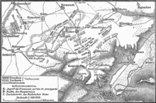
At the start of the Battle of Jena and Auerstedt , Napoleon , who bivouacked below the mountain the night before the battle, opened the cannonade at Closewitz on the foggy morning of October 14, 1806 around six in the morning. An audio walk by the Canadian artist Janet Cardiff can be borrowed from the museum in Cospeda to "relive" the battle in artistic form. Later on, the area was often used for military purposes, for example as a maneuvering area for imperial troops, for signal exercises for the indicators (with Zeiss devices), the cavalry of the Wehrmacht and also for tank exercises by the Soviet armed forces in the GDR period up to 1990.
The Windknollen is located northwest of the Saale valley Jena and is part of the Ilm-Saale-Platte .
The Windknollen nature reserve is located on the Windknollen as part of the FFH area "Isserstedter Holz - Mühltal - Windknollen". Numerous small bodies of water are the habitat for the northern crested newt and the European tree frog . The entire 195 hectare nature reserve has been for sale since 2018. The NABU Foundation National Natural Heritage was able to acquire a large part of the nature conservation areas .
photos
Individual evidence
- ^ Hermann Ortloff: Jena and the surrounding area. Paperback for strangers . Verlag von Carl Doebereiner, Jena 1864, p. 35 ( digitized version )
- ↑ Thuringian State Institute for Environment and Geology www.tlug-jena.de ( Memento from November 14, 2004 in the Internet Archive ) (PDF)
- ↑ Wind Lump is almost saved . NABU Foundation for National Natural Heritage, accessed April 28, 2020.
Coordinates: 50 ° 56 ′ 57 ″ N , 11 ° 34 ′ 24 ″ E


