Wood Lake, Minnesota
| Wood Lake | |
|---|---|
|
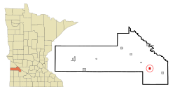
Location in Minnesota
|
|
| Basic data | |
| State : | United States |
| State : | Minnesota |
| County : | Yellow Medicine County |
| Coordinates : | 44 ° 39 ′ N , 95 ° 32 ′ W |
| Time zone : | Central ( UTC − 6 / −5 ) |
| Residents : | 439 (as of 2010) |
| Population density : | 209 inhabitants per km 2 |
| Area : | 2.1 km 2 (approx. 1 mi 2 ) |
| Height : | 321 m |
| Postal code : | 56297 |
| Area code : | +1 507 |
| FIPS : | 27-71446 |
| GNIS ID : | 654335 |
Woodlake is a small town (with the status " City ") in the Yellow Medicine County in the southwest of the US -amerikanischen state of Minnesota . In 2010 Wood Lake had 439 residents.
geography
Wood Lake is located at 44 ° 39'10 "north latitude and 95 ° 32'18" west longitude and extends over 2.1 km².
Neighboring locations to Wood Lake are Granite Falls (11.3 miles north), Echo (8.5 miles east-southeast), Vesta (15.4 miles southeast), Cottonwood (9.6 miles southwest), and Hanley Falls (10.1 km northwest).
The closest major cities are Minneapolis (218 km east), Minnesota's capital Saint Paul (234 km in the same direction), Rochester (287 km east-southeast), Sioux Falls in South Dakota (182 km southwest) and Fargo , North Dakota (304 km north-northwest).
traffic
The Minnesota State Route 274 has its southern terminus on the western edge of Woodlake. All other roads are subordinate country roads, partly unpaved roads or inner-city connecting roads.
In a northwest-southeast direction, a Minnesota Prairie Line railroad runs through central Wood Lake.
The Granite Falls Municipal Airport is located 14 km north of Woodlake. The nearest major airport is Minneapolis-Saint Paul International Airport (216 km east).
Demographic data
According to the 2010 census , Wood Lake had 439 people in 181 households. The population density was 209 inhabitants per square kilometer. Statistically, 2.43 people lived in the 181 households.
The racial the population was composed of 92.5 percent white, 4.6 percent Native American and 1.6 percent from other ethnic groups; 1.4 percent were descended from two or more races. Hispanic or Latino of any race was 7.5 percent of the population.
24.4 percent of the population were under 18 years old, 62.2 percent were between 18 and 64 and 13.4 percent were 65 years or older. 48.3 percent of the population was female.
The average annual income for a household was 45,417 USD . The per capita income was $ 23,702. 12.7 percent of the population lived below the poverty line.
Individual evidence
- ^ A b American Fact Finder. Retrieved April 10, 2013
- ↑ Distance information according to Google Maps. Accessed April 10, 2013
