Wyry (Sarny)
| Wyry | ||
| Вири | ||

|
|
|
| Basic data | ||
|---|---|---|
| Oblast : | Rivne Oblast | |
| Rajon : | Sarny district | |
| Height : | 172 m | |
| Area : | 1.638 km² | |
| Residents : | 2,016 (2020) | |
| Population density : | 1,231 inhabitants per km² | |
| Postcodes : | 34551 | |
| Area code : | +380 3655 | |
| Geographic location : | 51 ° 14 ' N , 26 ° 56' E | |
| KOATUU : | 5625480901 | |
| Administrative structure : | ||
| Address: | вул. Центральна буд. 2а 34551 с. Вири |
|
| Website : | Official website of the district council | |
| Statistical information | ||
|
|
||
Wyry ( Ukrainian Вири ; Russian Виры Wiry , Polish Wiry ) is a village in the Ukrainian Oblast Rivne with about 2000 inhabitants (2020).
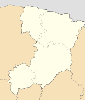
The village is located in the east of the Sarny district in the Polish lowlands ( Поліська низовина ), part of the Ukrainian shield at an altitude of 172 m , 35 km southeast of the Sarny district center and about 105 km northeast of the Rivne Oblast center . Wyry was affected by the Chernobyl nuclear disaster and is now located in the expanded Chernobyl exclusion zone, which is still radioactively contaminated .
The T-18-11 territorial road runs through the village and the M 07 / E 373 runs six kilometers north of Wyry . To the west of the village runs the railway line between Selyschtsche ( Селище ) and Klessiw .
The first time in 1597 in writing mentioned village is the administrative center of the rural community Wyry ( Вирівської об'єднаної територіальної громади Wyriwskoji objednanoji terytorialnoji hromady ) with more than 12,800 inhabitants (2020), to which even the villages Tschudel with 3036 inhabitants, Selyschtsche ( Селище ) 1500 population, Kamjane-Slutschanske ( Кам'яне-Случанське ) 1379 inhabitants, Oleksijiwka ( Олексіївка ) with 328 inhabitants, Fedoriwka ( Федорівка ) with 678 inhabitants, Hranitne ( Гранітне ) with 535 inhabitants, Dubnjaky ( Дубняки ) with 71 inhabitants, Sariwja ( Зарів'я ) with 257 inhabitants, Tschabel ( Чабель ) with 1090 inhabitants and Jasnohirka ( Ясногірка ) with 1521 inhabitants.
Before that, Wyry was the center of the 10.8674 km² district council of the same name, to which the villages Fedoriwka ( ⊙ ), Hranitne ( ⊙ ) and Oleksijiwka ( ⊙ ) belonged.
Web links
- Local history Wyry in the history of cities and villages of the Ukrainian SSR (Ukrainian)
- Municipal Council website on rada.info (Ukrainian)
- Wiry . In: Filip Sulimierski, Władysław Walewski (eds.): Słownik geograficzny Królestwa Polskiego i innych krajów słowiańskich . tape 13 : Warmbrun – Worowo . Walewskiego, Warsaw 1893, p. 568 (Polish, edu.pl ).
Individual evidence
- ↑ a b community structure on the official website of the rural community; accessed on May 26, 2020 (Ukrainian)
- ^ Radiological status of the areas with radioactive contamination. (PDF; 1.3 MB) 2008. Retrieved on May 26, 2020. (Ukrainian)
- ↑ Local website on the official website of the Verkhovna Rada ; accessed on May 26, 2020 (Ukrainian)
- ↑ Community map on the official website of the rural community; accessed on May 26, 2020 (Ukrainian)
- ^ Website of the district council on the official website of the Verkhovna Rada; accessed on May 26, 2020 (Ukrainian)

