Zadní Planina
| Zadní Planina
Plattenberg
|
||
|---|---|---|
|
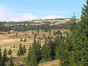
Zadní Planina peak. |
||
| height | 1423 m nm | |
| location | Sudeten | |
| Mountains | Giant Mountains | |
| Coordinates | 50 ° 42 ′ 43 " N , 15 ° 40 ′ 9" E | |
|
|
||
| rock | granite | |
The Zadní Planina ( Plattenberg ) is a mountain in the eastern part of the Giant Mountains main ridge in the Czech Republic.
location
The Zadní Planina lies in the central part of the Giant Mountains in the field of Czech national park Krkonošský národní park (KRNAP), about 4.5 km east of Spindleruv Mlyn (tschech. Spindleruv Mlyn , Polish. Szpindlerowy Młyn ) and about 6 km southwest of the Snow Mountain , the highest point of the mountains.
In the west, east and south the slopes are flat, only on the north side the rock faces are very steep. Here, together with the Luční hora ( high meadow mountain ) and the Stoh ( haystack ), it delimits the deeply cut valley of Dlouhý důl ( Langer Grund ).
Nearby peaks
| Kozí hřbety | Luční hora | Studniční hora |
| Stoh |

|
Lesní hora |
| Světlý vrch | Liščí hora |
Waters
Small rivulets flow from the gently sloping slopes in numerous cracks and gullies, without this being very noticeable in the landscape. Nevertheless, several watercourses arise in this very water-rich area.
The most important are in the east of Zelený potok ( Green Brook ) located in Pec pod Sněžkou ( sneak ) into the Upa ( Aupa ) opens, in the north of Svatopetrský potok ( ground water ) flowing in Spindleruv Mlyn in the Elbe River and eventually to the southwest of Klínový potok ( Keilbach ), which here with the Kotelský potok ( Kesselbach ) forms the Malé Labe ( Little Elbe ), the left tributary of the Elbe .
vegetation
The high areas are overgrown with scrub, in the lower areas spruce forests grow. Extensive mountain meadows can be found on the southern slope (Zadní Rennerovky) and on the southwest slope near the scattered settlement Klínové boudy ( Keilbauden ). The establishment of this settlement goes back to the year 1676.
tourism
Marked hiking trails and cross-country skiing trails belonging to the Krkonošská magistrála ( ski artery in the Giant Mountains ) lead along the slopes at an average altitude of 1350 meters. The summit itself is not accessible for nature conservation reasons.
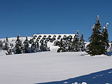
Between the Luční hora ( high Wiesenberg ) and the Zadní Planina, is located on the saddle Liščí hřeben ( Fuchs back ) the Chata Výrovka (former fir Baude or vultures watch ) a mountain lodge, one of which is also a restaurant. Further mountain huts are located near the two mountain meadows mentioned above.


