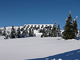
Stoh (Giant Mountains)
| Stoh
Haystack
|
||
|---|---|---|
|
View of Stoh and Dlouhý důl |
||
| height | 1315 m | |
| location | Sudeten | |
| Mountains | Giant Mountains | |
| Coordinates | 50 ° 43 '1 " N , 15 ° 38' 59" E | |
|
|
||
| rock | granite | |
The Stoh ( Haystack ) is a mountain in the eastern part of the main ridge of the Giant Mountains in the Czech Republic.
location
The Stoh is about 3.5 km east of Spindleruv Mlyn (Czech. Špindlerův Mlýn, Polish. Szpindlerowy Młyn) on the southern side of the valley Dlouhý důl (German Langer Grund , sometimes "St.Peter valley"). He is the first summit of the western foothills of the Giant Mountains and is approximately 1.5 km from Zadní Planina ( Plattenberg ) away. With the southwest lying Přední Planina it is connected by a flat saddle .
Nearby peaks
| Železný vrch | Kozí hřbety | Luční hora |
| Kohlova houština 1) |

|
Zadní Planina |
| Přední planina | Světlý vrch | Liščí hora |
1) Distinctive peak (876 m) at the entrance of the "Lange Grund", the valley of the "Svatopetrský potok" near Svatý Petr .
Names
The shape of the summit was reminiscent of a “haystack” or a haystack or haystack and therefore the Czech name corresponds to this image, because “Schober” means “stoh” in Czech.
Waters
The northern slope drops steeply into the Lange Grund and drains into the Svatopetrský potok (also Dolský potok ; German large groundwater, groundwater, Klaussenwasser). The source streams of the Malé Labe ( Little Elbe ) converge on the southern slope and form the left tributary of the Elbe .
Flora, fauna and nature conservation
The Stoh is located in the area of the Czech National Park Krkonošský národní park (KRNAP), which was founded in 1963 to protect endangered plant and animal species.
The upper areas of the mountain are densely covered by mountain pines . The original spruce forests on the slopes have been largely cut down. On the southern slope, near the scattered settlement Klínové boudy ( Keilbauden ), which was founded in 1676, you will find extensive mountain meadows. Here is the habitat for various butterfly species such as B. the Riesengebirgsspanner or the mountain Mohrenfalter and of course also for many bird species such as black redstart , meadow pipit and ring owl .
tourism
On the north-west slope the lifts of the ski center "Svaty Petr" lead to a height of up to 1122 meters. A total of four chair lifts and eleven surface lifts are in operation here in the winter season. In the summer season, a blue-marked hiking trail on the northern slope can be taken from Spindleruv Mlyn up to the Liščí hřeben ( Fox's back ). Here is on the saddle between Stoh and 100 meters higher Zadní Planina the hut Výrovka (formerly fir Baude or vultures watch ), a mountain cottage , is one of a restaurant. There are other mountain huts near the above-mentioned Klínové boudy.


