
Zamora Chinchipe Province
|
||
|---|---|---|
| flag | ||

|
||
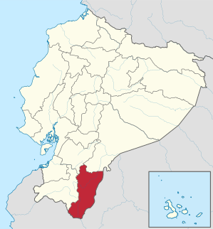
| Location in Ecuador | ||
 .svg) |
||
| Basic data | ||
| Capital | Zamora | |
| population | 91,376 (2010,) | |
| - Share in Ecuador | 0.6% | |
| - Rank in Ecuador | Rank 20 out of 22 | |
| - density | 8.6 inhabitants per km² | |
| surface | 10,584.28 km² | |
| - Share in Ecuador | 4.1% | |
| - Rank in Ecuador | Rank 11 of 22 | |
| License Plate | Z | |
| Set up | 1953 | |
| prefect | Franklin Delgado ( PSC ) | |
| governor | Jhonson Burguán | |
| Seats in the National Congress |
2 of 100 | |
| structure | 9 cantons | |
| ISO 3166-2 | EC-Z | |
| no official homepage | ||
Zamora Chinchipe is a province in Ecuador . It has almost 92,000 inhabitants on an area of around 10,600 km². Their capital is Zamora . The largest city and commercial center is Yantzaza .
location
The province is located in the southeast of Ecuador in the Oriente called Ecuadorian part of the Amazon lowlands . It borders in the west on the province of Loja , in the northwest on Azuay , in the north on Morona Santiago and in the east and south on Peru .
economy
Most of the people in Zamora Chinchipe live from agriculture. In addition, tropical woods are felled. Crafts are also located here.
The canton of Zamora in particular has long been known for its rich gold deposits . In some mines (e.g. Nambija ) gold is still mined today, but using rather ancient methods.
politics
Prefect of the province is Franklin Delgado, who was elected in 2004 for an electoral alliance made up of Partido Social Cristiano and the political movements Movimiento Independiente por el Cambio and Fuerza Joven por el Cambio . The mayor of the capital Zamora, Héctor Apolo, was elected for an electoral alliance between the PSC and the social democratic Izquierda Democrática . Benito Suquisupa, the mayor of the largest city, Yanzatza, is a member of the Partido Socialista - Frente Amplio , the Socialist Party of Ecuador.
The governor appointed by the government of Ecuador is currently Johnson Burguán.
history
The provincial capital Zamora was founded in 1550 by Alonso de Mercadillo , who also built Loja .
The province emerged from the Oriente province, founded in 1911, and the province of Santiago-Zamora, which was spun off from it in 1920 and which was divided into two provinces on November 10, 1953. The northern part formed the province of Morona Santiago (with capital Macas ), the southern Zamora Chinchipe.
Due to its exposed location on the border with Peru, the east of the province has repeatedly been the scene of armed conflicts between the two neighboring countries. In particular, the Cordillera del Condor (see explanations under Morona Santiago ) was the scene of the Peruvian-Ecuadorian border war in 1981.
Cantons
The province of Zamora Chinchipe currently has nine cantons. These are (in order of their establishment):
- Zamora (established in 1911, capital: Zamora )
- Chinchipe (established in 1921, capital: Zumba )
- Yacuambi (established in 1921, capital: 28 de Mayo , also known as San José de Yacuambi ; on May 28, 1944, during the "May Revolution", the dictatorial President Carlos Alberto Arroyo del Río was removed from office by peaceful civil protest)
- Yanzatza (established 1981 Capital: Yanzatza ; Yanzatza means Valley of the Fireflies in the language of the Shuar )
- Nangaritza (established in 1987, capital: Guayzimi)
- El Pangui (established in 1991, capital: El Pangui)
- Centinela del Cóndor (established 1995; capital: Zumbi)
- Palanda (established in 1997; capital: Palanda)
- Paquisha (established in 2002; capital: Paquisha)
Web links
- News from and information about the province (span.)
- Information about the province (span.)
- Information about the province (on the pages of the magazine Vistazo ; span.)
Individual evidence
- ^ INEC, Población total y tasas brutas de natalidad, mortalidad general, mortalidad infantil y materna según regiones y provincias de residencia habitual, año 2010 ( memento of June 8, 2006 in the Internet Archive ), accessed on October 13, 2010.
- ↑ see Marc Becker, "Nonviolent Insurrection in Ecuador: The 1944 Glorious May Revolution" (2003), online at http://www.yachana.org/research/confs/phs2003.pdf
Azuay | Bolívar | Cañar | Carchi | Cotopaxi | Chimborazo | El Oro | Esmeraldas | Galápagos | Guayas | Imbabura | Loja | Los Ríos | Manabí | Morona Santiago | Napo | Orellana | Pastaza | Pichincha | Santa Elena | Santo Domingo de los Tsáchilas | Sucumbíos | Tungurahua | Zamora chinchipe
Coordinates: 4 ° 14 ′ S , 78 ° 50 ′ W