Vaksdal
| coat of arms | map | |
|---|---|---|

|
|
|
| Basic data | ||
| Commune number : | 4628 | |
| Province (county) : | Vestland | |
| Administrative headquarters: | Dale | |
| Coordinates : | 60 ° 36 ' N , 5 ° 49' E | |
| Surface: | 715.38 km² | |
| Residents: | 3,977 (Feb 27, 2020) | |
| Population density : | 6 inhabitants per km² | |
| Language form : | Nynorsk | |
| Website: | ||
| traffic | ||
| Railway connection: | Bergensbanen | |
| politics | ||
| Mayor : | Hege Vik ( Sp ) (2019) | |
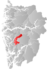
| Location in the province of Vestland | ||

|
||
is aNorwegian municipalityin the province (Fylke)Vestland. The municipality borders in the southwest on the municipality ofBergen, in the west onOsterøyand - beyond the Romarheimsfjord - onAlver, in the north onModalen, in the northeast onVik, in the east onVoss, in the southeast onKvamand in the south onSamnanger. The municipal center is in the village of Dale.
The nature of the municipality is characterized by characteristics of the Norwegian west, namely the fjords and fell areas around Bergsdalen.
coat of arms
Description : Three black weaver shuttles set in gold as stakes .
Economy and Transport
The then very modern mill in the village of Vaksdal (Vaksdal mølle) was, like the industrial area in Dale, an industrial center of the municipality. Today "Dale" knitwear is the most famous product of the municipality.
The Bergen Railway runs through the municipality and the E 16 between Bergen and Oslo also crosses its territory.
The Bolstadstraumen bru in the course of the Fylkesvei 569 over the narrow point of the Vikafjord called Bolstadstraumen was one of the first network arch bridges .
