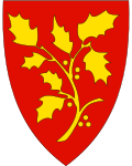
Stord
| coat of arms | map | |
|---|---|---|

|
|
|
| Basic data | ||
| Commune number : | 4614 | |
| Province (county) : | Vestland | |
| Administrative headquarters: | Leirvik | |
| Coordinates : | 59 ° 48 ' N , 5 ° 28' E | |
| Surface: | 143.73 km² | |
| Residents: | 18,759 (Feb 27, 2020) | |
| Population density : | 131 inhabitants per km² | |
| Language form : | Nynorsk | |
| Website: | ||
| politics | ||
| Mayor : | Gaute S. Epland ( Ap ) (2017) | |
| Location in the province of Vestland | ||

|
||
Stord is a municipality in Fylke Vestland, Norway . It is located on the island of Stord, where it borders to the north with the municipality of Fitjar , which is also on the island of Stord . Furthermore, the municipality includes the islands Huglo, Storsøya and Tanøy well as many small islands and bars . The municipality belongs to the Sunnhordland region . Stord comes from the Old Norse language and roughly means "the erect one".
Stord has city status. The administrative center of the municipality is called Leirvik. Around 14,000 people live here. Sagvåg is the second largest town with around 4,000 inhabitants.
Economy and Transport
Aker Kværner Stord in Leirvik is the largest shipyard in Norway. Aker Kværner Stord has built and equipped the largest oil platforms in the world, the Gullfaks C. and Troll platforms .
A tunnel and bridge system ( Trekantsambandet ) has been connecting Bømlo and Stord since April 30, 2001 . The European route E39, the main connection between Bergen and Stavanger , crosses the island. There are ferry connections from Skjærsholmane to Ranavik (island Halsnøy ) and Sunde in Kvinnherad municipality and from Jektevik to Hodnanes on Tysnes and Huglo. There are daily scheduled flights to Oslo from Stord Airport, Sørstokken .
Personalities
- Ivar Braut (* 1956), Bishop of Stavanger
- Kari Veiteberg (* 1961), Bishop of Oslo
- Olav Akselsen (* 1965), politician
- Geirmund Brendesæter (* 1970), football player
