Ziegelbach (Reuss)
| Ziegelbach | ||
|
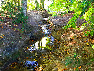
Ziegelbach near Talachere |
||
| Data | ||
| Water code | CH : 570847 | |
| location | Canton of Aargau ; Switzerland | |
| River system | Rhine | |
| Drain over | Reuss → Aare → Rhine → North Sea | |
| source | near Bündtenmättli , Oberwil-Lieli 47 ° 20 '26 " N , 8 ° 22' 57" E |
|
| Source height | 561 m above sea level M. | |
| muzzle | in the Flachsee near Unterlunkhofen Coordinates: 47 ° 19 '53 " N , 8 ° 21' 54" E ; CH1903: 670 019 / 242690 47 ° 19 '53 " N , 8 ° 21' 54" O |
|
| Mouth height | 380 m above sea level M. | |
| Height difference | 181 m | |
| Bottom slope | 82 ‰ | |
| length | 2.2 km | |
| Catchment area | 64 ha | |
| Left tributaries | paradise | |
| Communities | Oberwil-Lieli , Berikon , Zufikon , Unterlunkhofen | |
The Ziegelbach is a 2.2 kilometer long right tributary of the Reuss in the municipalities of Oberwil-Lieli , Berikon , Zufikon and Unterlunkhofen in the Swiss canton of Aargau . It drains an area of around 64 hectares on the western slope of the Holzbirrliberg .
geography
course
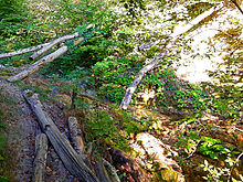
The stream rises in a convoluted position at 561 m above sea level. M. at the Bündtenmättli district of the Oberwil-Lieli community. After running 400 meters in a north-westerly direction, the stream comes to the surface and turns to the south-west. Here it first forms the municipal boundary to Berikon, then that of Zufikon. It now reaches the Hard forest area , where the stream has created a small ravine, and overcomes almost 100 meters in altitude. At the end of the ravine, he passes over completely to Zufiker's territory. It leaves the forest a little later, flows through the fields in the Talachere corridor for about 200 meters and crosses a short section of the Nüeschwald after breaking through a moraine wall . Here it takes on the only tributary, the Paradies creek , and crosses under the side street between Zufikon and Unterlunkhofen, only shortly afterwards to 380 m above sea level. M. to flow into the Reuss dammed up here to form the Flachsee .
Catchment area
The 0.64 km² catchment area comprises small parts of the Bremgarten district and consists of 72.7% agricultural area, 19.7% natural area and forest and 7.6% built-up area. The highest point of the catchment area is 593 m above sea level. M. reached at the Flur Im Falter , the average height is 507 m above sea level. M.
In the north lies the catchment area of the Chränenbüelbach and in the south that of the Oberwiler Dorfbach , both of which also drain into the Reuss.
Web links
swell
Individual evidence
- ↑ a b individual records of the geographic information system of the canton of Aargau
- ↑ a b Geoserver of the Swiss Federal Administration ( information )
- ↑ Total catchment area number 128631. In: Topographical catchment areas of Swiss waters: area outlets . Retrieved October 11, 2015 .


